End of the 16th century. The victories of Yermak's squad over the troops of the ruler of Siberia, Khan Kuchum. The story “Description of the new lands, that is, the Siberian kingdom” said: “... and so by the grace of God and the sovereign happiness and providence and zeal, the ataman Yermak and the comrades of the Siberian Gentiles of many hordes and the tongue of the military people were beaten in that battle and taken live bait ... Tsar Kuchum, seeing the strength of his people, many beaten, from a city with small people, he fled to his wife, the queen, and to his children, to his beloved village on Obalak, from Tobolsk ... "
Some leaders of the Siberian tribes went over to the side of the Russians, while others continued for some time to resist the onslaught of the Cossacks and service people of the Moscow Tsar.
In the 17th century, European politicians wondered how, in just fifty-five years, "Muscovites were able to rapidly advance from the Ural Mountains to the Pacific coast." They were also surprised that as a result of this advance on the vast territory of Siberia, new Russian villages, cities, Orthodox churches were just as quickly erected, industrial enterprises were organized, peasant farms arose and, no less important, cooperation between Russians and Siberian tribes and peoples was established.
On the way to the unknown ocean
“Summer 7146, August on the 6th day (1638 August 6) the sovereign king and Grand Duke Mikhailo Fedorovich and all Rus', ordered the stewards and voivodes Pyotr Petrovich Golovin, and Matvey Bogdanovich Glebov, and the clerk Efim Filatov to go to Siberia, to Tobolsk, and from Tobolsk to the Yenisei prison, and from the Yenisei prison to the great Lena River ... ".
This royal decree on the establishment of the Yakut voivodeship appeared six years after the founding of the prison Yakutsk on the Lena, “... that great river Lena is pleasing and spacious, and there are a lot of people along it, nomadic and sedentary pink lands and sables and all kinds of other animals; and how the sovereign will point out to that great river Lena to send more than enough Siberian people and orders to build a city or prisons, where it is more convenient, and orders to bring people under your sovereign’s royal high hand along that great river Lena and along other rivers of new lands ... ".
Founded in 1632, Yakutsk became a kind of base for exploring Eastern Siberia, the Pacific Ocean and the coast of North America.
“... And along the great river Lena, rowing down to the midnight okiyan for two months or more, and sailing weather will run for a week.
And on both sides of the great rivers of Lena and up to the mouth of the midnight Okiya, Yakuts, Tunguses, Mayads, Panagirs, Koyaty, Karigils and many other nomadic and sedentary people. Yes, in the same de great river Lena below the Vilyui mouth, many great rivers slept on both sides, and on those rivers live axes, Tungus, Shamagiri, Bayakhts and many other people, and there are a lot of sables and every animal and fish along those along all rivers ... ".
Departing from Yakutsk, Russian pioneers reached the rivers Indigirka, Alazeya, Kolyma. In the forties of the 17th century, the Cossack and navigator Mikhail Stadukhin built three fortified winter huts in Kolyma. These small villages allowed the Russians to get comfortable, securely settle in this area and carry out trips to the shores of the Arctic and Pacific Oceans.
Few names of glorious explorers and sailors of those times have been preserved - participants in travels from Lena to uncharted lands. Among them: Elisey Yuryev, Yeleska Buza, Ivan Rebrov, Ilya Perfilyev. With their comrades, they made geographical discoveries, paved the way to the ocean and to the mainland, not yet knowing that the ocean was called the Pacific, and the mainland - America.
Ninety brave
According to historical documents, Russian travelers reached the shores of the Pacific Ocean in the 30s of the XVII century. But it may have happened before.
The great expanse of water with its indomitable temper began to gradually reveal its secrets to the pioneers. One of the conquerors and explorers of the Pacific coast was Semyon Ivanovich Dezhnev. He served in Yeniseisk, Tobolsk, Yakutsk. For some time he was in the detachment of Mikhail Stadukhin on the Oymyakon River.
In 1647, the clerk of the Ustyug merchant Fedot Alekseev (known by the surname Popov) assembled a team to sail the Arctic Sea to the East, from the mouth of the Indigirka. He was interested in walrus hunting. The expedition was also entrusted with the study of "uncharted shores" and the search for new "obscure people."
The detachment was headed by Semyon Dezhnev. By that time, the forty-two-year-old Cossack, for his courage, experience and business acumen, was well known and respected among sailors, servicemen and merchants from the banks of the Lena to the Kolyma.
On four kochs, a detachment under the command of Dezhnev entered the East Siberian Sea. But that summer, an unusually powerful accumulation of ice did not allow the planned voyage to be completed.
In June 1648 the campaign was repeated. This time 90 people participated in the expedition. Seven koches left the mouth of the Kolyma and headed to the East.
There are different versions of what happened to these ships. According to one, several ships died during a storm, according to another, they were carried to the shores of America, and the surviving Russian sailors settled forever in Alaska.

Semyon Dezhnev mentioned in his report: “And that Fedot (Fedot Alekseev Popov) with my Family, was blown up at sea without a trace. And it carried me, Semeyka (as Dezhnev called himself in the note), across the sea after the Intercession of the Virgin (after October 1/14) everywhere involuntarily, and threw me ashore at the front end of the Anadyr River. And there were twenty-five of us on the koche. And I, poor Family, and my comrades went exactly ten weeks to Anadyr ... "
There is no unequivocal opinion about the further fate of the expedition members. But it is indisputable: three out of seven kochas, rounding the Chukchi Peninsula from the north, passed the strait between Asia and America. The voyage of Dezhnev and his comrades proved that these two continents are separated by water.
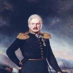
The surviving members of the expedition founded the Anadyr prison, explored and mapped the banks of the Anadyr River. Subsequently, Semyon Ivanovich made many more trips along the northeastern rivers of Siberia. Moscow highly appreciated his merits. Tsar Alexei Mikhailovich awarded Dezhnev the rank of Cossack chieftain. In 1667, thanks to the discoveries and research of Semyon Ivanovich, an image of the North-East of Russia was plotted on the geographical map "Drawing of the Siberian Land". However, the report of the glorious pioneer about the existence of a strait between Asia and America remained unclaimed in the archive for a long time.
Only in the 30-40s of the 18th century, during the Great Northern Expedition, Gerard Friedrich Miller, a member of the St. Petersburg Academy of Sciences, found and published this document.
"Someone Fedot lived there"
The reference literature about Fedot Alekseev Popov says: "The years of birth and death are unknown." It remains a mystery what actually happened to him after the storm separated the expedition ships. There is an assumption that the koch, on which Fedot Alekseev Popov and the Cossack foreman Gerasim Ankudinov and his comrades were, reached Kamchatka.
A lot of fragmentary information about their future fate has been preserved. In his report, Semyon Dezhnev reported: “... I, Semeyka, defeated the Yakut woman Fedot Alekseev from the Koreans. And that woman said that de Fedot and the service man Gerasim died of scurvy, and other comrades were beaten, and small people remained and fled in boats with one soul, nowhere to go.
Almost a century after the expedition of 1648, the scientist and traveler Stepan Petrovich Krasheninnikov wrote: “Who was the first of the Russians in Kamchatka, they do not have reliable evidence, but according to verbal reports, this is attributed to a certain merchant Fedot Alekseev, after whom the river flows into Kamchatka It's called Fedotovshchina.
The version about the stay of Fedot Alekseev Popov on the peninsula was also mentioned in his notes by academician Gerard Miller: “The rumor circulating among the inhabitants of Kamchatka, which from everyone who has been there, is confirmed.
... they say that many years before the arrival of Volodymyr Otlasov (Vladimir Atlasov - a Cossack explorer) to Kamchatka, a certain Fedotov son lived there on the Kamchatka River at the mouth of the river, which is now called Fedotovka after him, and lived with children from Kamchatka, who then at the Penzhina Bay, where they crossed the rivers from Kamchatka, they were beaten by the Koryaks. This Fedotov's son, in all appearances, was the son of the aforementioned Fedot Alekseev ... "

But these references to Popov raise doubts among some modern historians. The fate of one of the Russian pioneers of the 17th century remains an unsolved mystery.
Descendants of the missing?
Jakob Johann Lindenau, a member of Vitus Bering's expedition, translator of the St. Petersburg Academy of Sciences, has been researching the tribes and peoples of North-Eastern Siberia for many years. His pen belongs to the well-known work in the 18th century: “Description of the Tunguzes on foot, or the so-called Lamuts.”
Lindenau managed to record the stories of the Chukchi about the northern Pacific islands and the shores of the New World. Of course, the word "America" was not known to this people at that time.
“Near the Chukchi Nose there is one island under the north and four islands to the east, and Chukchi live on those islands.
And not far from the last distance is meant by their rank Big Earth(meaning Alaska), which is so called because that land is more than their Chukchi land and they are Chukchi from their dwellings to that land go by canoes and bring wooden dishes from that land, like Russian dishes. And according to the ranting of those Chukchis, there is news through the Russian people for sure, that supposedly the merchant people twelve years past for seventy or more Kolyma middle winter quarters, where the fair used to be for the bargaining of those who went and from strong sea weather, having dispersed from each other, some sailed through Kamchatka, and others landed on that island, which they called the Greater Land, and the peoples living there, mating with them, married and bred.
Scientist naturalist, participant of the Second Kamchatka expedition Georg Wilhelm Steller, who collected a rich collection of American flora in 1741, wrote: “Among the Americans, allegedly, there lives a people who are completely identical to the Russians in figure, manners and customs; Anadyr Cossacks of the opinion that these are the descendants of persons who left the Lena on horseback and disappeared without a trace.
It is highly plausible that their flat ships were thrown on land by a storm, and the local population forced them to stay here.
The stories of Russian sailors of the second half of XVII I century that the natives of Alaska were pagans, but at the same time they knew some biblical traditions. These legends they heard from their ancestors.
Who and when first told the people of Alaska Bible stories? There is no reliable answer yet.
In the early 90s of the 18th century, the “Historical Report Card of Russian Voyages and Discoveries in the Northeast Sea” was published in St. Petersburg.
In this work, an unknown author wrote: “The opinion of many foreign writers [it] is very unfounded that the Russians, before transforming their foreign customs into a state of hostility against the scientists of the European peoples, did not have such a spirit and ability to turn their attention to the most useful discoveries beyond the limits of the conquered in 1697 Kamchatka land. The spirit of the always indefatigable Russians did not only carefully try to find out the places, lands and peoples beyond Kamchatka lying, but also went into very difficult and almost impossible trials in the Arctic Sea even before the conquest of Kamchatka.
... the enterprise was in 1646 a ship's passage between the eternal ... [ices] and the Chukotskaya nose lying between north and east, not far from the American materago coast and stretching to the unknown limits of North America, has long been bypassed by the sea and therefore that small the strait that separates Asia from America, which other nations have not known before."
Unknown notes by Ivan Rubets
In the late 70s of the last century, the author of this book met in Boston with Russians of the White émigré wave. Two of them, Alexander Nikolaev and Ivan Pozykov, were fond of the history of Russian America. After retiring, both of them visited the Pacific coast - from the former Fort Ross to Alaska.
Nikolaev and Pozykov were convinced that the leader of the Cossack detachment, Mikhail Stadukhin, and not Semyon Dezhnev, was the first to prove by his journey the existence of a strait between Asia and America. At the same time, amateur historians relied on the notes of the navigator and explorer Ivan Rubets. They had seen this document in the possession of some Californian antiquarian before World War II.
Their words were astonishing. After all, little is known about this Anadyr Cossack, who lived in the middle of the 17th century. His notes were not mentioned in Russia either in scientific or even in fiction. Only a few lines of ancient documents testify to the deeds of Ivan Rubets.
In 1661, a record was made in Yakutsk: “... On June 6, the great sovereign was sent to serve overseas on the Anadyr River foreman Cossack Ivan Rubets, and with him 6 service people. And those service people were given a koch ... "
As follows from the documents of the 17th century, in the summer of 1662 Ivan Rubets and his comrades managed to cross the strait separating Asia and America. However, there is no mention that the Cossack foreman reported this in writing to his superiors.
In the 17th century, many statesmen, navigators, merchants and scientists of Europe closely followed the discoveries of Russians in the Arctic and Pacific Oceans and possible visits to the northwestern shores of America.
In 1664, the Dutch geographer Nikolaas Witsen arrived in Moscow. He collected information about the expeditions of Russian sailors and explorers in Eastern Siberia. The Dutchman was especially interested in whether they managed to find a strait between Asia and America.
Subsequently, after returning to his homeland, Witsen wrote that the northwestern coast of America was visited by Russians, and he managed to collect a lot of supporting documents. “When I made my first map, I wrote at the bottom: “It is not known if one peninsula is connected to America.” But since then I have received more detailed information and now I know for sure that all this is separate, so I myself have now amended my map, ”said Nikolaas Witsen.
In 1692, a book by the Jesuit d'Avril was published in Paris. Referring to his conversations with the Russian governor Musin-Pushkin, he wrote that winds and currents sometimes carry Asian walrus hunters on ice floes to unknown lands: “... I have no doubt that many of the hunters, captured in the same way, swim on ice floes to the northern cape of America, very close to this part of Asia, ending in Tatar (probably d "Avril meant the Chukchi Peninsula). I am convinced in my opinion that the Americans, who live on the part of America that stands out further than others in the sea on this side, are of the same species with the islanders ... "
One of the first
There are many facts when European scientists, diplomats and travelers in the 17th century, referring to Russian sources, announced the possibility of penetrating the Pacific Ocean through the Arctic Ocean, the possibility of reaching the shores of America and advancing to India and China.
In those days, foreigners, visiting Muscovy, not only wrote down stories about the wanderings of Russian navigators and explorers from the words of knowledgeable people, but also bought and even stole documents and maps of the expedition. According to Nikolaev and Pozykov, in this way the recordings of Ivan Rubets could end up abroad, and then fall into the hands of a Californian collector.
Many European countries still keep rarities and documents related to Russian travels to the shores of America.
Do the recordings of Ivan Rubets really exist? If so, who specifically keeps them? Couldn't find out. Maybe future researchers will be lucky.
One of the researchers of the history of Russian America called the 17th century for Russia "a century of long-standing journeys, significant discoveries" ... And also - "the time of Rus''s touch with America."
Perhaps the Cossack foreman Ivan Rubets became one of the first Russians to make this “touch”.
SIGNS ON THE MAP
Terra incognita - these words excite the imagination. Ancient people were drawn to unknown lands by the voices of sirens; the echo of these voices resounds in our hearts even now, when on modern maps we see spaces designated as unexplored... the most difficult task combining individual elements of existence to create a coherent representation of the whole.
(Jen K. Wright. President of the Association of American Geographers. XX century)
The first experiments of Russian cartography
It was possible to discover an unknown land in ancient times without geographical maps. There are many examples in history when, at the behest of storms, torn off ice floes with people or ships washed up on unfamiliar shores. It happened that navigators were looking for some geographical objects, and discovered completely different ones.

The development of Siberia, the determination of the borders of the state, the settlement of relations with neighboring countries, the search for a sea route from the Arctic Ocean to India and China, and hence the resolution of the question of whether Asia and America were separated, required the development of cartography in Russia. Back in the 15th century, when Muscovy began to unite into a powerful state, attempts were made to create geographical maps of the country.
In the first half of the 16th century, by order of the Grand Duke of Moscow Vasily III, a census of settlements was carried out, boundary, boundary, road drawings were drawn up. These documents became the basis for the creation of geographical maps of Russia.
During the reign of Ivan the Terrible, European scientists, researchers, diplomats Anton Vid, Sigismund Herberstein and others used the work of Russian cartographers in their writings.
The most famous geographical map of Russia in the 16th century, drawn up at the end of the reign of Ivan the Terrible, was called the "Big Drawing".
Heir to the throne - cartographer
Under Tsar Boris Godunov, two of his relatives were associated with the development of Russian cartography.
The young son of the monarch, Fyodor Borisovich, received a decent education for his time. At the age of 13-14, he became interested in drawing maps. There is an assumption that the king found some ancient geographical documents in the archives. They were in a deplorable state and required restoration. Boris Godunov nevertheless managed to discern unknown lands and seas on them. The tsar decided: the shabby maps should be kept secret for the time being, even from his close associates.
But who is to entrust the secret restoration of important documents?
Boris Godunov chose his son. Fifteen-year-old Fedor not only coped with the difficult task of his father, but also took part in compiling the best map of Russia for that time.
After the death of Tsar Boris, he ascended the throne, but soon, at the age of 16, he was meanly killed by traitors to the motherland, supporters of False Dmitry I.

The Polish invaders, with the help of Russian henchmen, captured Moscow in June 1605. The conquerors exported from Russia not only material values. They were interested in books archival documents and geographical maps. They confiscated all the works of Fedor that fell into their hands.
The secret carried away by the head of the political detective
The second cousin of Tsar Boris, Semyon Nikitich Godunov, headed the political investigation under him. At the end of 1604, Semyon Nikitich returned to Moscow from Astrakhan. There he negotiated with the Nogai prince Ishtereke and managed to convince him to go over to the side of Russia. The king's brother brought with him from the Nogai possessions a geographical map, made by no one knows who and when, although the names and explanations on it were in Russian. However, Semyon Nikitich was most surprised by the outlines of the northeastern outskirts of Siberia and the “unknown land” separated by a strait. According to historical documents, early XVII centuries, Russian explorers have not yet been east of the banks of the Ob.
After the capture of Moscow by False Dmitry I, Semyon Godunov was exiled to Pereyaslavl. But he did not live there long. At first, some foreigner visited him from the capital. He tried to find out where the geographical map brought from the Nogai possessions was hidden.
How the interrogation ended is unknown. Soon Semyon Godunov was killed. Was there really a map made before the 17th century showing northeastern Siberia and the strait separating Asia and America? Searches in the archives of Russia and the United States have not yet given an answer to this.
Monument of Russian historical and geographical thought
Compiled in 1570 in the Moscow Discharge Order, the map "Big Drawing" was highly appreciated by scientists and specialists in Europe. But time passed, new lands, rivers, lakes, sea coasts opened up, the borders of the Russian state expanded. The "big drawing" needed improvements and additions. Such work was done in 1627. In addition to the geographical map, the "Book of the Big Drawing" appeared. It was a description of the Muscovite state.
In the introduction of this remarkable monument of Russian historical and geographical thought, it was noted: “According to the Sovereign Tsar and Grand Duke Mikhail Fedorovich of All Russia, by decree, a drawing was found in the Rozryad of the old drawing of the entire Muscovite state for all the neighboring states, and in that drawing and the measure of versts, and miles, and horse driving, how much to drive during the day by a stanitsa ride for a day is written, and the measure is set for versts.
And that old drawing is dilapidated, henceforth it’s not good to look at the tracts, it was beaten all over and fell apart ...
And in the Razryad, the clerks, Duma Fyodor Likhachev and Mikhailo Danilov, ordered, trying on that old drawing, to the same extent to create a new drawing for the entire Muscovite state, for all neighboring states ... from the mouth of the Tenuya River, by the sea coast to the east to the mouth of Kola; and from the mouth of the Kola by the sea coast to the Solovetsky inversion to the mouth of the Ntsva River to the east by the sea coast to the Sumy Ostrog and to the mouth of the Onega River; and from Onega to the mouth of the Dvina River; and from the Dvina to the mouth of the Pechora River, to Pusto Lake, and from Pustoozero to the mouth of the Knyazkovoi River and the Narymsky bank to the river to the Ob, rivers and all sorts of tracts; and across the river beyond the Ob by the seashore to the Taza River and the Pura River to Mangazeya; and along the Yenisei river ... ".
Although the “Book of the Big Drawing” reflected the expansion of the expanses of the Moscow state, it did not yet contain either the Chukotka Peninsula, or the Pacific Ocean, or the coast and islands of America. All these geographical features appeared on maps only in the 18th century.
Only copies of the “Book of the Great Drawing” have survived to our time, and the map itself has not been preserved.
"And Siberia takes shape"
In 1667, the Tobolsk voivode Pyotr Ivanovich Godunov compiled a new map of Siberia. By that time, Russian pioneers in northeast Asia had made expeditions to the Lena, Indigirka and Kolyma, founded settlements on the Lena and in other East Siberian lands. And the Cossacks, merchants, fur hunters have already heard a lot from northern peoples about the mysterious "great land", which can be reached by moving "towards the sun".
At the very end of the 18th century, Tsar Peter I, studying the map of governor Godunov, on which there was no Taimyr, Chukotka, or Kamchatka, said: "And Siberia is taking shape." To this the sovereign himself put a lot of effort.
In 1698, the historian, geographer and cartographer Semyon Ulyanovich Remezov compiled a "Drawing of all Siberia". His work was approved by Peter I. Inspired by the success and royal praise, Remezov continued his studies in cartography. To help, he attracted his sons - Ivan, Leonty and Semyon.
By 1701 they had completed the Drawing Book of Siberia. In addition, they compiled the so-called "Remizov Chronicle". It reflected in detail the events of the conquest and development of the Trans-Ural lands by the Russians from 1576 to 1598.
As the famous historian Professor S. V. Bakhrushin noted at the beginning of the last century: "Remezov, the author of a remarkable geographical atlas of Siberia ... His description of the conquered lands provided rich material on the ethnography of the region." Bakhrushin also emphasized that the works of Semyon Ulyanovich and his sons "... were revealed to Western Europe hitherto unknown corner of Asia: according to the Russian map, copied by the Swedes, immediately after its appearance, the outdated map of Herberstein was corrected ... ".
In the 18th century, the further spread of Russian possessions beyond the Urals went in two directions: in the northeast to the Chukotka Peninsula and the islands of the Arctic and Pacific Oceans, to the shores of America, and to the south - to the upper reaches of the Ob, Irtysh, Ishim and Yenisei. This advancement was reflected in the works of Semyon Remezov and his sons.
The “Drawing Book” compiled by them, apparently, is the first Russian Geographical Atlas, that is, a systematic collection of maps, designed in the form of an album and combined common idea. This atlas had 23 geographical maps of both the whole of Siberia and its individual sections. America, the shores and islands of the Pacific Ocean were not yet designated in it.
Thanks to the work of Pyotr Godunov, Semyon Remezov and his sons, as well as the studies of many Russian pioneers and sailors of the 17th-18th centuries, Siberia really “gained contours” on the geographical map.
"The Land Revisited"
Many researchers believe that the outlines of Alaska and some of the North Pacific islands of America appeared on the Russian map in 1700. Its creator was the Yakut governor Dorofey Traurniht. On the so-called "Mourning drawing" to the east of Chukotka there was a large island with the name "Land again explored." So Dorotheus Traurnicht called Alaska in his work. The word "Alaska" will come into use in Russia only decades later.
In 1697, the Yakut governor received an order from Moscow to organize an expedition to find a way from the Arctic Ocean to the Pacific. Traurnicht himself did not participate in the campaigns, but collected geographical information from Russian pioneers. One of these discoverers of lands in the northern part of the Pacific Ocean was the Cossack Vladimir Vasilyevich Atlasov. Back in 1672, he was recruited to "searching for new lands." He was rightly called the "Kamchatka Ermak", and in the reference literature they wrote that Atlasov was an outstanding explorer, "who completed the great Russian geographical discoveries of the 17th century in Siberia with the study of Kamchatka."
Records of the Cossack Pentecostal Vladimir Atlasov about his campaign have been preserved. They mention unknown islands: “And between the Kolyma and Anandyr rivers, the necessary nose, which fell into the sea (which cannot be bypassed), and on the left side of that nose there are ice on the sea in summer, and in winter that sea is frozen: and on the other side of that there are ice on the nose in the spring ... And he Volodimer (Atlasov) did not visit that necessary nose.
And the local foreigners of the Chukchi, who live near that nose and at the mouth of the Anadyr river, said that there is an island opposite that necessary nose; and from that island in the winter, when the sea freezes, foreigners come, speak their own language and bring thin sables, like a ferret beast; and those sables… he saw Volodimer. And the tails of those sables are a quarter of an arshin long, with transverse black and red stripes.
Most likely, Atlasov saw the skins of raccoons with striped tails, which were found only in North America. In his reports, he reported on nature, the customs and habits of the peoples of Kamchatka, Chukotka, and Alaska.
New confirmations
In 1713, the explorer and traveler Grigory Novitsky completed his work entitled " Short description about the Ostyak people, who are found within the full-night kingdom of Siberia. In this book, he mentioned an unknown land - probably Alaska, and the strait, through which you can get from the Arctic Ocean to the Pacific.
Long before the expedition of Vitus Bering, the Russian pioneers of northeastern Siberia not only heard about the tribes of America, but also met with their representatives.
In a book published in 1758, "Description of sea voyages in the Arctic and Eastern Sea", Academician of the St. Petersburg Academy of Sciences Gerard Miller made an interesting entry. It dates back to about 1715. It reported on a resident of Alaska who, by chance, came to the Russians: “... There lived a foreign man in Kamchatka, who ... announced himself that he was born in a land where tall cedar trees grow, and on them nuts are much larger than Kamchatka; and this de land lies from Kamchatka to the east ...
It de has large rivers that flowed into the Kamchatka Sea (as the Bering Sea was called at that time). The inhabitants of de name tontala; in habits they are similar to the Kamchadals and use the same leather boats or canoes as the Kamchadals for the waterway. Many years ago, he came with his countrymen to Karaginsky Island, where his comrades from the local inhabitants were killed, and he, left alone, went to Kamchatka ... "
One of the Cossacks, according to a resident of Alaska, tried to sketch a map of the "great land" "beyond the sea to the east." She was sent to Yakutsk. Whether this geographical document has been lost or is still kept in an archive or in someone's collection is unknown.
At all times behind each sign on the geographical map stood the fate of people, dangerous adventures, searches, discoveries, successful or unsuccessful travels. The signs on the map are both a call to a long journey, and the result of this journey. They are milestones in the movement towards the knowledge of the planet.
IN THE INTERESTS OF RUSSIA, BY THE WILL OF PETER
... a few days before his death, he remembered his old thought about finding a road to China and India by the Arctic Ocean. Already suffering from near-death attacks, he was in a hurry to write instructions for Bering's Kamchatka expedition, which was supposed to investigate whether Asia in the northeast was connected to America ...
(Vasily Osipovich Klyuchevsky about Peter I. 1901)
The order of the Evreinov expedition
“I foresee that the Russians someday, and perhaps during our lifetime, will shame the most enlightened peoples with their successes in the sciences, indefatigability in labor and the majesty of firm and loud glory,” wrote Peter I.
The desire to find out whether there is a strait between the Arctic Ocean and the Pacific, arose from him during his trip to Europe at the end of the 17th century. Probably, meetings and conversations with foreign scientists contributed to this. However, at that time Russia did not yet have its own navy, and the country's external and internal affairs did not allow the young sovereign to equip expeditions to the shores of the Pacific Ocean.
But the victory over the Swedish army in 1709, the victory of the young Russian fleet at Gangut in 1714, the development of Siberia, the development of navigation, industry and science in the country allowed Peter I to return to old plans.
At the beginning of 1719, he instructed the surveyors Ivan Evreinov and Fyodor Luzhin to go to the Pacific Ocean and explore if there was a strait between Asia and America. Why was it necessary to find out what was discovered by Russian pioneers in the 17th century? But - documents are lost, and many finds of the past are subject to oblivion.
True, there is a version that Peter still knew about the campaigns of Popov, Stadukhin, Dezhnev and other glorious travelers. And finding out the existence of the strait between Asia and America was only a cover for the true intentions of the sovereign.
As noted by domestic and foreign researchers, at the beginning of the 18th century, Russia needed new lands rich in fur-bearing animals. By that time, the extraction of valuable furs in Siberia had declined. Thus, in order not to displease competitors - European colonial countries (England, Spain, Holland, France), Peter I classified the study of the Pacific coast of North America.
In the tsar's instructions to Ivan Evreinov and Fyodor Luzhin, it was emphasized: “You must go to Tobolsk and from Tobolsk take an escort to go to Kamchatka and further where you are indicated. And describe the places where America has converged ... "
Evreinov and Luzhin completed the expedition and arrived in 1722 to Peter I for a report. However, the route of their journey did not come into contact with America. The northern part (up to the island of Simushir) of the Kuriles was surveyed and mapped, the coordinates of 33 points of Kamchatka and Siberia were determined.
The sovereign approved the results of the expedition of Ivan Evreinov and Fyodor Luzhin. Biographer of Peter I Ivan Golikov wrote about this meeting that the emperor “... with great curiosity spent some time with him (with Evreinov. - Auth.) in conversation and with pleasure examined the map of Kamchatka and the aforementioned islands, composed by him and his comrade, Luzhin, and a description of their entire voyage.
The documents of that time do not indicate whether Peter I mentioned "the land on the other side of the Pacific Ocean" during this meeting. After all, the travelers did not follow the instructions: "... describe the local places where America has converged."
Such silence aroused suspicion among some researchers: maybe Evreinov and Luzhin did visit the coast of the New World? .. But, probably, the sovereign decided for the time being to keep their voyage to America in the strictest confidence.
The discovery of the New World from the Pacific Ocean still holds many mysteries.
Emperor's Last Instruction
At the end of 1723, Peter I again ordered Evreinov to be summoned to him. Ivan Mikhailovich at that time worked as a topographer in Vyatka. The sovereign wanted to instruct him to go on an expedition a second time to explore the American coast "near Asia."
The royal order was not carried out. Evreinov died in February 1724. Whom to appoint instead of an experienced traveler and surveyor? Peter chose Vitus Bering.

On January 6, 1725, a few days before his death, the emperor wrote instructions for a new expedition:
"one. It is necessary in Kamchatka or in another place to make one or two boats with decks.
2. On these boats [to sail] near the land that goes to the north and aspirations (I don’t know the end of it) it seems that that land is part of America.
3. And in order to look for where she met America, but also to get to which city of European possessions or, if they see a European ship, visit from it, as this bush (shore) is called, and take it on a letter and visit it yourself shore and take a genuine statement and put it on the map, come here ... "
It was one of the last documents signed by Peter I. Nineteen days later, on January 28, 1725, he died.
First Kamchatka expedition
In the first quarter of the 18th century, Russian pioneers strove for the shores of America not only on orders from the capital. In 1720-1725, the sea expedition of the industrialist and navigator Prokopy Nagibin took place. As a result of this trip, it was possible to collect some information about the Pacific coast of the New World.
In those same years, other Russian people were able to visit Alaska and the Aleutian Islands. But their records have probably been lost.
A native of Denmark, Vitus Bering entered the service in the Russian fleet in 1704. He was then 23 years old. By the time he was appointed head of the First Kamchatka Expedition, he had gained rich experience as a navigator.
Bering's assistants were naval officers Alexei Chirikov and Martin Shpanberg. The expedition was provided with 158 people: surveyors, blacksmiths, sailors, soldiers, carpenters, etc. At the end of January 1725, the advance detachment of the First Kamchatka Expedition, led by Alexei Chirikov and midshipman Peter Chaplin, left Petersburg with a convoy to the east. The commander himself joined them a few weeks later.
Only after 3 years, Bering's detachment, having overcome about 10 thousand kilometers, reached the Nizhne-Kamchatsky prison. A few months later, an expedition ship-boat “St. Gabriel".
The voyage began in July 1728. "St. Gabriel" entered the Pacific Ocean, headed north along the coast of the Kamchatka Peninsula, and then headed for Chukotka.
The first Kamchatka expedition discovered the land, which was named the island of St. Lawrence, and reached a latitude of 67 degrees and 18 minutes. Bering, despite the objections of Chirikov, decided not to continue moving north, because he considered that the issue of the existence of a strait between Asia and America had been resolved.
On the way back, an island was discovered, which received the name of St. Deomid. Subsequently, it turned out that in fact these are two islands. Nowadays, one of them, Ratmanov Island, belongs to Russia, the other, Krusenstern Island, belongs to the USA.
The expedition returned to Kamchatka and, having wintered there, set sail again in the summer of 1729. This time, Vitus Bering intended to reach the shores of America. However, weather conditions did not allow this plan to be carried out.
The Admiralty Board considered the results of the First Kamchatka Expedition unsatisfactory. But Vitus Bering did not receive any penalties. Taking into account the experience and knowledge of the navigator, he was again appointed head of the expedition, which was called the "Second Kamchatka".
As noted by Russian and foreign researchers, the Second Kamchatka, or Great Northern, expedition in terms of its tasks, the number of participants, the coverage of water and land territories and scientific results surpassed all known in history. It consisted of several detachments of travelers who explored the vast expanse of water and the shores of the Arctic and Pacific Oceans.
Journey of Gvozdev and Fedotov
Shortly before the start of the Second Kamchatka Expedition, in the summer of 1732, navigator Ivan Fedotov and surveyor Mikhail Gvozdev sailed and reached Alaska. On the ship "St. Gabriel”, preserved from the expedition of Bering, the travelers reached the eastern tip of Asia. Then they crossed the strait that separates Asia and America, and ended up off the coast of Alaska.
Mikhail Gvozdev wrote about this event: “August 21 days after midnight at 3 o’clock the wind began to rise, they raised the anchor, spread the sails and went to the mainland, anchored and there were no dwellings against that, and the navigator Ivan Fedotov ordered to raise the anchor . And they went near the Earth to the southern end ...
From the southern end to the western side they saw yurts - dwellings of a verst and a half, and it was impossible to get close to these de yurts behind the wind, and they went near the ground to the south side, and it became a shallow place, they threw lots, depths of 7 and 6 sazhens, and from that place they returned back and began to laver near the mainland (Alaska. - Auth.), to blow to the earth, and the wind began to be great from the land opposite ...
And from this Big Land it was blown away by such a great wind, and the wind de was north-nor-west. And from the fourth de island, he rowed the Chukchi to the board in a small yalych, according to them called Kukhta ... Gvozdev, through the interpreter, asked about the Great Land: what kind of land, and what kind of people live on it, and is there a forest, also rivers, and what animal. And he de, the Chukchi, told the interpreter and called the Big Land, and de their own Chukchi live on it, and the forest de has the rivers, and about the animals he said that he has a wild deer, marten and fox, and decided beavers.
Russian travelers, due to weather conditions, failed to land on American soil. As the researchers suggest, the ship "St. Gabriel approached Alaska near Cape Prince of Wales, and a day later visited King Island, or Ukivok. It was there that the Russians met with the locals.
In September 1732, the expedition of Mikhail Gvozdev and Ivan Fedorov returned to Kamchatka. Thanks to this journey, for the first time, sections of the Asian and American coasts, separated by the Dezhnev Strait, were correctly depicted on a geographical map.
Soon after the completion of the voyage, Ivan Fedorov died, and Mikhail Gvozdev ended up in prison. For several years, the notes of their journey to the "Great Earth" remained unknown to anyone.
The participants of the Second Kamchatka Expedition still managed to find some of these documents and get acquainted with the released Mikhail Gvozdev. But as the writer and researcher Sergei Markov noted, the map of the 1732 trip to St. Gabriel" disappeared, and it was only approximately restored according to Ivan Fedorov's notes.
ALLOWING LIGHTS
... Columbus Rossky,
despising gloomy rock,
Between the ice the way will be opened to the east
And our power will reach America ...
(Mikhail Lomonosov)
The Sitka tribe has a silent tradition about white people washed ashore many years ago.
... Chief Annahuts dressed in a bearskin and went ashore. He depicted the waddling gait of the beast with such accuracy that the Russians, carried away by hunting, went deep into the forest, where the native warriors killed them all to the last.
(T. L. Andrews)
No name for him
Long, tiring flight from New York to Alaska.
And then I failed...
In whatever seas and lands she overtakes you, she has the same habits.
An unexpected blow to ideas and plans. The dream shatters into many fragments and seems to fall into an invisible abyss. People around become gloomy and do not look into the eyes. The voices of birds sound different. Trees and grasses bow to the wind, exhausted. Sea waves crash. And the heavy rains are starting...
This is how failure comes.
The wind from the ocean was trying to blow through the window of my room. The sound of raindrops waxed and waned. And from these sounds it was clear that the bad weather had come for a long time.
And this means that the helicopter promised to me will not rise above the town of Juneau, proudly called administrative center Alaska. And I can no longer visit the island where Russian sailors landed almost two and a half centuries ago and for some reason did not return.
An unsolvable riddle!
Or is someone still lucky, and failure will let him go to find an answer? For the time being, she left me rains and winds, and even cold rational thoughts. What did you want to find on that island? Do you really hope that for two and a half centuries at least some sign of the disappearance of travelers has remained? ..
The world has become different. The land and waters have changed beyond recognition. Other herbs and trees have grown. Even on the stones, prescription has probably erased the traces of human hands ...
And failure is right.
Reconcile? Wait another day or two, and then return to New York without even touching the mystery?
But maybe I can still see in the twilight of bad weather the cherished lights of the “path to the unknown”?
If you believe the stories of local residents, the spirit of passion and excitement loves to play with people. He drops heavenly lights, and on earth they form a "path into the unknown." The playful spirit beckons people to step on this path, intoxicating with a sense of close luck and happy change...
Was it not he who, back in 1741, enchanted Russian sailors and led them into the unknown?
I asked my acquaintances from Juneau, what is the name of this mysterious spirit of passion, excitement, suspense?
And they answered me: there is no name for him.
Packets "St. Peter" and "St. Paul"
The second Kamchatka expedition lasted from 1733 to 1743. More than 600 people took part in it, 13 ships were involved.
In the summer of 1740, the construction of the ships "St. Peter" and "St. Paul". They were intended for navigation in the Pacific Ocean. According to contemporaries, the ships were suitable for any sea trials. From Okhotsk, the packet boats made the transition to the Avacha Bay of Kamchatka. There, preparations for a long voyage continued.
Finally, on June 4, 1741, the St. Peter" and "St. Pavel "left Kamchatka and headed for the shores of America ...
Separation in the fog

“... they left the harbor of the holy apostles Peter and Paul for a raid in the Avacha Bay of the Maya on the 29th, in which, after a contrary wind, they stumbled on June until the 4th, and on the 4th, with calm, they went to the sea and followed a certain course to the land of Ianda Gamma ... ".
So Alexey Chirikov reported about the beginning of the voyage to the Admiralty Board in December 1741.
The expedition planned by Peter the Great continued.
Bering's deputy and commander of the St. Pavel, lieutenant commander Alexei Ilyich Chirikov, according to contemporaries, was one of the best officers and the hope of the Russian fleet.
The Admiralty instructions of the expedition noted that when the shores of America were reached, “... then visit them and find out what kind of peoples there are and how that place is called and whether those shores are truly American and doing that ... put everything on the map and then go for that as for reconnaissance near those shores, how much time and opportunity will allow ... ".
The first days the expeditionary ships went together. But on June 20, 1741, heavy fogs began. Neither the experience of Bering and Chirikov, nor the sound signals helped. Packets "St. Peter" and "St. Paul" lost each other.
Fog separated Vitus Bering and Alexei Chirikov forever.
unknown land
After unsuccessful searches for each other, the ships of the Second Kamchatka Expedition continued on their way to the shores of America, but each on its own course. The crew of Chirikov, consisting of 75 people, continued to perform everyday work: astronomical observations, measurements of ocean depths, studying currents and winds, amending the map, preparing for a meeting with the unknown Pacific coast of America.
Finally, on July 15, the travelers saw the land - the island, named on modern maps Baker, which is located off the coast of North America south of Alaska.
With excitement, Russian sailors looked at the unknown land. Snow-capped mountains, small bays, sea birds and animals - all this reminded me of Kamchatka. And yet there was something new and peculiar in what he saw.
Did anyone think during those hours on the St. Pavel", what is the discoverer of America from the Pacific Ocean?
In his report, without any victorious pathos and enthusiasm, somehow in an everyday way, Chirikov noted: time, moving away from the coast, at midnight at 5 o'clock, since the wind was capable of us, we turned north to that rhumb, as the last part of the earth lay, seen from us to the north of the past evening, and at midnight at 10 o'clock at of this land we passed a distance of half a verst, because it was very foggy, and in order, moving away from it, we went somewhat parallel to it between the north and the west ... and, if an unfortunate accident, which is below this clear, had not prevented, I hoped a considerable part America to describe ... "
In response - unkind silence
On July 18, Chirikov ordered the yalbot to be sent ashore. The boat accommodated ten sailors, headed by navigator Avram Dementyev.
Chirikov wrote detailed instructions on what to do and how to behave on the American coast.
“... when, with God's help, land on the shore, then see if there are inhabitants on it and, if you see inhabitants, then show them pleasantness and give gifts ...
... and if no one knows the language, then at least signs - what kind of land is it and people under whose authority and call them several people to visit us on the ship;
... to see if there is a convenient place for the arrival of a ship from the sea where it would be safe to stand and measure such a harbor by lot and make a drawing ...
... to see what forests and grasses grow on the shore;
... are there any excellent stones and land in which you can expect to be rich in ore ...
... from the inhabitants, as much as possible, to inquire where this land extends and whether there are rivers flowing into the sea from it and where those rivers flowed into the sea;
... if the inhabitants turn hostile, then defend themselves from them and, as soon as possible, return to the ship, and do not do any bitterness to them ...
... to return to the ship on the same day, or at least the next day ...
... as God brings it to the shore, then to let us know, launch a rocket ... and being on the shore, lay out a big fire, if you see that we can see it ... ".
Alas, there were no signals from Dementyev's detachment either that day or the next.
Hours of suspense dragged on slowly. The sailors took turns climbing the mast of the packet boat to get a better view of the shore through the fog.
Despite the unfavorable weather, Aleksey Chirikov kept the ship under light sails in a perilous proximity to the island.
Only seven days later, the long-awaited fire broke out on the shore.
Bonfire! Alive!
Joyfully excited on board the St. Pavel”: obviously, something happened to Dementiev’s boat and his team cannot return to the ship. Hastily began to collect a new detachment to the island.
The last boat remained on the packet boat. The boatswain Sidor Savelyev and three other sailors set out to rescue their comrades.
Chirikov ordered the ship's cannons to be fired several times so that they would know on the shore that help was near. But there were no responses.
On the island - fog and unkind silence.
On the way back
“... And since then the weather was very calm, then in the meantime they let him go to the shore and themselves followed him to the shore and came very close and saw that the boatswain approached the shore in a boat about noon at 6 o’clock, precisely determined from I didn’t repair the signals and didn’t return to us at a reasonable time, and the weather was the quietest ... ”.
So noted in the report Alexei Chirikov.
There were no boats left on the packet boat, which means that communication with the shore was lost. Travelers could no longer help their comrades on the island, nor get drinking water.

On July 25, two boats were spotted from the ship. They walked from the bay, where the teams of Dementyev and Savelyev landed.
Chirikov ordered the packet boat to be sent towards the boats.
Joyful mood on board the St. Paul" quickly faded away. The travelers soon saw that these were not their boats.
Several rowers on them were most likely from the Tlingit tribe. Swimming closer to the ship, the Indians jumped to their feet and shouted: “Agay! Agay!
Then they waved their hands. The Russian sailors could not understand either their words or gestures.
The Tlingit took up the oars again and turned towards the island. The heavy packet boat could not catch up with the nimble Indian boats. The ship followed them to a dangerous limit. It was impossible to get closer to the shore. To be aground meant the certain death of both the ship and the entire crew.
The travelers now realized that fifteen of their comrades had either died or were held captive by hostile Indians.
It was bitter to realize such a loss and his impotence, the inability to help his comrades.
“... we walked near that place until evening, waiting for our ships, only at night we moved away from the shore for fear, and at night we had a lantern with fire on the stern flask, so that, if more than expected, they would blow out, so that they could come to us at night ... "- recalled Alexey Chirikov.
Stocks fresh water there was very little left on the ship. You can't reach Kamchatka. It was impossible to continue the expedition and explore new lands without boats.
For the last time, the packet boat "St. Pavel" walked past the ominous, mysterious shore. Another volley of cannons - and the ship moved into Return trip to Kamchatka.
Despite the loss of life, the illness of many sailors, the lack of water, the disappearance of boats, the expeditionary detachment under the command of Alexei Chirikov completed its task - opened the Pacific coast of North America. More than 400 kilometers of its coast were mapped for the first time.
different versions
Hearing from Alexei Chirikov a story about the disappearance of sailors, Sven Waxel came to the conclusion: “It can be assumed with good reason that when they (the sailors under the command of Dementiev) approached the shore, the Americans (Indians) probably hid, and that the people who arrived on boats, unaware of the danger that threatened them when landing on the shore, dispersed in different directions for water.
Thus, they, presumably, were separated from each other when the Americans, having finally seized a convenient time, suddenly appeared between them and the boat, blocking the way back ... "
The writer, author of the book "Bering" Nikolai Chukovsky did not agree with the conclusions of Sven Waxel. He believed that the coast, where the sailors disappeared from the ship "St. Pavel", was inhabited by peaceful Indians - Tlinglits, who would not attack strangers.
In addition, it is not so easy to defeat a detachment of sailors armed with rifles and pistols, using only spears and bows.
Nikolai Chukovsky was inclined to the version that both boats of the St. Pavel" died in a whirlpool. Whirlpools, dangerous for small boats, often form during high tides off the northwest coast of the United States. In the eighties of the XVIII century, approximately in the places where the sailors from the ship "St. Pavel", died in the whirlpool of the boat of the French traveler Jean-Francois Laperouse.
"Ageoy" - lights from heaven
A little more than thirty years after the Second Kamchatka Expedition, the Spanish court received a message from their American colony that there was a settlement of Russian people in California. How these people got there is unknown. Since the time of the Second Kamchatka Expedition, not a single Russian ship has yet come to the shores of America.
My grandfather Grigory Burlak traveled the Pacific coast of the United States from California to Alaska at the beginning of the 20th century in search of work. He also had a chance to visit the Alexander Archipelago, discovered by the expedition of Alexei Chirikov.
On one of the islands of the archipelago, grandfather heard from the locals a story about how many years ago, bright, bearded people who sailed on a big ship from “the land where the sun goes”, were bewitched by “Ageoy”.
When my grandfather asked what this word means, they explained to him: "Ageoy" - lights that fell from the sky.
What a misfortune happened later with bearded fair people - they said different things. Some claimed that the "path of heavenly lights" took the aliens to the magical land of Gemm. Others said that a spirit without a name told the bearded people to make boats and sail towards the sun to the mainland and start there. new life.
Then this story did not interest my grandfather. Only many years later, when he read about Chirikov's expedition and about fifteen missing sailors, did grandfather remember the legends he had heard on the Alexander archipelago.
The report of the expedition mentioned that the Tlinglit Indians, who sailed from the island, shouted the word "Agay". Maybe they didn’t hear on the packet boat and wrote down “Agai” instead of “Ageoi” incorrectly? ..
Of course, my grandfather later regretted that he did not ask in detail and did not write down the stories of the inhabitants of the archipelago. He didn't get to go there again.
Who knows, maybe the old Indian legends would at least slightly lift the veil over the mystery of the disappearance of fifteen Russian sailors?
"The path to the unknown" from the lights that fell from heaven ...
Everyone sees in these lights what he wants to see when he begins his journey along the "path into the unknown." But at the end of the journey, "everyone gets what they deserve"...
That's what my friends from Juneau said. Thus spoke to them the spirit of passion and excitement, which has no name and which intoxicates people with a sense of near success and happy change.
For those who have set foot on the "path into the unknown", it seems that this is the righteous path. To others, beckoning lights appear as precious stones that lead to earthly wealth. Still others see something mysterious in them, which must be comprehended and experienced ...
I returned to New York without having visited the land that holds the secret of fifteen Russian sailors.
In the porthole of the plane, in the darkness, some islands were barely visible. Could this be the Alexander Archipelago?
I wanted to believe it. As well as the fact that the multi-colored lights below are a mysterious "path to the unknown" of the spirit of passion and excitement, and not just the light of electric bulbs of settlements and sea ships.
From ocean to ocean
In New York, I told the story of the missing Russian sailors to the well-known American journalist Art Shields. Once he worked as a correspondent in Moscow, and before the First World War he lived for many months in Alaska.
It turned out that at one time Art studied the materials of the Second Kamchatka Expedition and even wrote down several legends related to the mysterious, in his opinion, the disappearance of sailors from the St. Paul".
From a Russian emigrant living in New York, Shields got acquainted with a handwritten copy of the notes of the famous businessman and researcher Grigory Ivanovich Shelekhov.
In the second half of the 18th century, Grigory Ivanovich was the organizer of permanent Russian settlements in Alaska and on the islands of the northern regions of the Pacific Ocean.
In 1788, Shelekhov's envoys met in Alaska, in Yakutat Bay, light-eyed, fair-haired, tall white people. They lived in a tribe of Koloshi Indians, spoke their language, but differed in manners and attire.
When Shelekhov was informed about this meeting, he immediately remembered the stories about the missing sailors from the St. Pavel "and decided that the fair-haired Indians were their children or grandchildren.
Around the 1870s, an unusual, silent old man appeared in New York. He knew only a few words in English.
He was met by hunters in the upper reaches of the Delaware River. With signs, gestures, in separate words, the old man managed to explain that many years ago, on the ocean shore, he was captured by some Indians. At first, they gave him and his comrades - Russian sailors - a bowl of hot broth.
Then oblivion came. How long it lasted - the old man either did not know, or was unable to explain. He did not see his comrades from the ship again. He, then still a young, strong man, the Indians decided to make a "white shaman."
From the island where he was captured, he was transported to the mainland. This path was not easy. In the boat, the future "white shaman" was constantly given a drink, from which at first the head was spinning, and then consciousness was lost.
How and what the “supreme teacher of shamans” taught the Russian sailor, the old man could not tell. When, after many months, the "hour of initiation" came, the teacher cut a vein in the sailor's arm and tasted the blood. Then he explained that blood is bad, and a stranger cannot become a shaman. And the Indians will not forgive this and will give the pale-faced man as a sacrifice to the white wolves.
For some reason, the Russian sailor liked the "supreme teacher of shamans", and he advised the unfortunate student to run - all the time towards the sun, until he comes to the shore of another ocean. And there, if he does not meet happiness, then at least he will find peace.
The sailor followed the advice. For more than twenty years he moved from the shores of the Pacific Ocean to the Atlantic. Overcame rivers, dense forests, lakes. Several times the sailor was captured by the Indians of different tribes. Sometimes he ran away, but more often the Indians, having learned what path he had traveled and how much he still had to go, set him free as a sign of respect.
It is not known whether the Russian sailor met happiness in New York - "on the shore of another ocean", as the "supreme teacher of shamans" prophesied to him. Did you find peace in an unfamiliar city? Was he really in the crew of St. Paul"?
There is no documentary evidence of all this ... Another undisclosed secret of Russian America.
In the XII-XX centuries, Russian navigators, explorers and natural scientists discovered a great many geographical objects listed on modern map peace. Only a small part of our great discoverers is familiar to readers from textbooks of geography and history. In his book "Pioneers" Mikhail Tsiporukha collected invaluable information about those travelers whose names are undeservedly forgotten today.
The book contains biographies of Russian explorers, exciting stories of their travels, cultural essays on the life of little-known peoples and descriptions of geographical objects made during the expeditions. Each chapter is dedicated to a different traveler. Ancient maps, archival materials perfectly complement and illustrate the publication.
Mikhail Isaakovich Tsiporukha
PIONEERS
RUSSIAN NAMES ON THE MAP OF EURASIA
Going for a dream
In the 17th-20th centuries, Russian navigators, explorers and natural scientists discovered for the country and the world many geographical objects in the northern seas, in Siberia and the Far East, in Central and Central Asia - islands and peninsulas, bays and straits, rivers and lakes, mountain peaks and ranges. Dozens and hundreds of new names appeared on the maps, associated with the names of Russian travelers and explorers. Enlightened Europe and the rest of the world admired them, our ancestors. “The advance of the Russians through Siberia during the 17th century,” wrote the English scholar J. Baker, “went with stunning speed ... This obscure army gets such a feat that will forever remain a monument to its courage and enterprise and which no other European people has done ".
Our famous travelers S. I. Chelyuskin, the Laptev brothers, N. N. Miklukho-Maclay, N. M. Przhevalsky, I. F. Kruzenshtern, G. I. Nevelsky, F. F. Bellingshausen are known both in Europe and in Australia and in America.
This book tells about those researchers whose names are not so well known. Unfortunately, they are rarely remembered, and many of them are forgotten or almost forgotten. However, the activities of these pioneers, who passionately dreamed of unexplored lands, were aimed at the benefit of the country and greatly contributed to the development of domestic science, inherited by the same dreamers, passionate people - scientists of our time.
M. Tsiporukha
Ivan Moskvitin
TO THE SERIOUS SEA OF OKHOTSK
Her cliques sounded through the ages!
We walked, blind, and you opened up to us,
Quiet! Great!..
That's what we were waiting for, the children of the steppes!
Here it is, the element akin to the heart!
A miracle happened: on the verge of
Became Russia!
(Valery Bryusov)
In the 30s of the 17th century, Russian Cossacks and industrialists entrenched themselves in Yakutsk on the Lena and, based on Lena prisons and winter quarters, in search of "new lands" moved both by sea to the east from the mouth of the Lena, and directly east along the land, and to south along the Lena and its right tributaries. Vague rumors reached them from local tribes that a huge sea stretched in the east, and in the south a wide, full-flowing river "Chirkol or Shilkor" flows behind the ridges (it is clear that it was undoubtedly about the Shilka and Amur rivers).
Tomsk Cossack ataman Pentecostal Dmitry Epifanovich Kopylov, serviceman Foma Fedulov and Yenisei clerk Gerasim Timofeev on January 11, 1636 filed a petition to the Tomsk governor Prince Ivan Ivanovich Romodanovsky, in which they claimed that they knew the way "to the Siviryuyu River, and many Tungus live on that river ... but on you , sovereign, yasaka (tax, which was collected in valuable furs) was not washed from those Tungus, and your sovereign people served in those lands. Petitioners asked the prince to let them go to this river and supply the expedition with weapons and food.
The voivode sent 10 cavalry and 40 foot Cossacks with Kopylov on a campaign. In 1637, Kopylov led a detachment from Tomsk to Yakutsk, the main prison of the Lena Land. The detachment even included a clerk and a blacksmith "for squeaky handicrafts and for all kinds of ship affairs." Probably, no one in Yakutsk could show Kopylov the way to this mysterious river, on the banks of which one could get a lot of "soft junk", that is, valuable furs. Oddly enough, the ataman chose the right direction.
In the spring of 1638, Kopylov’s detachment, with the interpreter-interpreter Semyon Petrov, nicknamed Chistoy, taken from Yakutsk, descended the Lena to the mouth of its right tributary, the Aldan, and then climbed up it for five weeks on poles and tow. At the end of July, 100 versts (about 107 kilometers) above the mouth of the May River, the right tributary of the Aldan, Kopylov set up the Butal winter hut and explained to the surrounding Tungus (now they are called Evenks) and Yakuts. This winter hut became the base for the formation of reconnaissance detachments to find a way to unknown seas and rivers.
It was there, in the Butala winter hut, that the earliest information about the existence in the lower reaches of the Chirkol River flowing into the sea of the "silver mountain" (Mount Odzhal) was obtained. But in Rus' at that time there was an acute shortage of silver. That is why it was decided at the end of 1638 to send a special expedition from Aldan to search for this mountain.
In the late autumn of 1638, Kopylov sent a detachment of Cossacks to the upper reaches of the Aldan in order to find the mysterious "Chirkol", but the lack of food forced the messengers to return. From the inquiries of local residents, the Cossacks learned that there was a large sea behind the Dzhugdzhur mountain range. The idea arose of sending an expedition to the mouth of Chirkol along this sea.
In May 1639, Kopylov sent a detachment led by Tomsk Cossack Ivan Yuryevich Moskvitin to reconnoiter the path to the "sea-ocean". The detachment included 20 Tomsk Cossacks and 11 Krasnoyarsk Cossacks. The detachment was led by Evenk guides. The detachment consisted of the Cossack Nehoroshko Ivanovich Kolobov, who, like Moskvitin, presented in January 1646 a "skazka" about his service in this campaign. Both of these "tales" were important documents that shed light on the circumstances of the exit of Russian explorers to the Sea of Okhotsk.
Here are the lines from the "skask" of the Cossack Nekhoroshka Ivanov, the son of Kolobov.
"In the past, in 147 (1639) from the Aldan river from the Bhutan prison, the Tomsk ataman Dmitry Kopylov sent Tomsk service people Ivashka Yuryev, the son of Moskvitin, and their Cossacks, with him thirty people to the great sea of Okyan, in the Tungus language to Lama .
And they went down the Aldan down to the May river for eight days, and up the May river they went up to the portage for seven weeks, and from the Mai river in a small river to a straight portage in shavings they went six days, and the portage went on for a day and went to the river on the Ulya to the top, Yes, that River Hive went down a plow for eight days, and on the same River Hive, having made a boat, they sailed to the sea to the mouth of that River Hive, where it fell into the sea, five days. And here they, at the mouth of the river, set up a winter hut with a prison.
Shortly after the Moskvitin detachment reached the Maya River in June 1639, it turned out that among the Tungus who accompanied the Cossacks as leaders (guides), there were two women who had already been to the Amur region. They were the first to inform the Cossacks that the lower part of the Chirkol River is also called Omur or Amur. So for the first time the Russians learned this new name - Amur, and subsequently the well-known geographer of the second half of the 17th century, the Dutchman N. Witsen, defined it as the "Moscow word".
The road to the Sea of Okhotsk along an unfamiliar route was difficult and dangerous. With considerable effort, the Cossacks dragged the boats along the shallow rivers. On the way, they often had to leave alone and build new plows and boats, overcoming portages and waterfalls in the mountainous sections of the rivers. It was truly a journey into the unknown.
Primary school teacher
GBOU secondary school No. 947
Nikolaeva Yulia Alekseevna
ABSTRACT
history lesson
held in 3rd grade
on the topic "Russian pioneers.
Geographical position Asia."
Topic: Russian pioneers. Geographical position of Asia»
Tasks:
Educational: expand our understanding of the world around us; introduce the conqueror of Siberia - Yermak, the discoverer Nikitin.
Educational: cultivate love for the subject.
Developing: develop the ability to observe, draw conclusions.
Equipment:
Physical map of Russia
Presentation;
Cards;
Country name cards
Literature:
Lesson planning for the textbook N. Ya, Dmitrieva.
Board decoration
Physical
map
Russia
Stages
During the classes
Notes
I Organizational part
Hello guys! Have a seat.
II Statement of the problem
Today we will go on a very interesting journey with you and become real explorers. We will get acquainted with some Russian pioneers, as well as with the geographical position of Asia and the natural conditions on its territory. Guys, tell me, please, what is Asia? Well done. Indeed, Asia is one of the parts of the world on our planet. But before doing the research, let's formulate the questions we want to find answers to. Guys, what would you like to learn at the lesson today? (What was the name of the Russian pioneers? What territories did they discover? Where is Asia located? What does this part of the world look like on the map? What is the climate in Asia?...)
Well, we have formulated questions on the topic, and during the lesson we will try to answer all these questions.
Posting questions on the board
IV Discovery of new knowledge about Asia
Four centuries ago, to the east of the Ural Mountains, lands unknown to explorers lay. They said that behind the stone (as the Ural Mountains were called at that time) lies an immense land - go at least 2 years and you will not reach the end. In this region, there are untold riches: a lot of fur-bearing animals, fish, and in the icy Arctic Ocean - marine animals. Sable and arctic fox skins and walrus tusks were especially highly valued. And so, to the east, to the expanses of Siberia and the Far East, Russian people "capable of any work and military deed" went. These brave brave people who discovered new lands beyond the Ural Range were called pioneers. Even in the years Horde yoke long-distance travels of Russian people did not stop. At that time, these lands were sparsely populated. And now, before you go on a journey with the pioneers, check how you know how to navigate.
Determine which side of the world is in relation to Moscow the White Sea, the Azov and Baltic Seas and the Pacific Ocean. Well done! What is hidden on the map behind the green, yellow and brown colors? (Plain, desert, mountains)
Novgorod played an important role in expanding the geographical knowledge of the Russian people (Slide 2). Over time, the path "from the Varangians to the Greeks" lost its meaning. Tell me, please, from which sea did this path go? (From Baltic to Black) Quite right! What was its purpose? (trade route between Scandinavia, Northern Europe, Byzantium and Asia) Well done! As I said, this path has lost its meaning over time. Trade relations between Rus' and Europe went through Novgorod and further along the Baltic Sea.
Novgorodians also paved the way to the North. First, they discovered the White Sea, on the islands of which the famous Solovetsky Monastery was founded. (Slide 3) It became the base for further travels. (Slide 4) Novgorodians on boats-ushkis went to the Barents Sea, and then along the coast, where on boats, where on dry land, they moved east (Slide 5) to the Kara Sea. Beyond the Urals, the Novgorodians found themselves in a part of the world that was unfamiliar to Russian people at that time - Asia. (Slide 6) In the north, travelers were met by harsh nature: a treeless swampy plain - tundra, short summer with the sun that does not set around the clock; (Slide 7) a long winter, when the polar night lasts for many months with fierce frosts and severe snowstorms. But the Novgorodians again and again sailed there in their small boats. They were attracted by the abundance of valuable fish, sea animals and fur-bearing animals. They also discovered many islands of the Arctic Ocean.
Listen to how the indigenous peoples - the Nenets - characterize their land: (Slide 8) “When visiting us, do not forget a fur hat, a warm coat and felt boots. We will ride reindeer and feed you deliciously cooked fish.”
(Slide 9) And to the south, to Palestine, where there are many shrines of the Orthodox Church, Russian priests traveled. It was also Asia - hot, dry, mountainous, alien to the Russian people, accustomed to the expanses of the plains.
(Slide 10) To the east, to Mongolia, during the time of the Horde yoke, Russian princes went to bow to the supreme Mongol khan. This is already the center of Asia, where steppes and deserts languish in summer from unbearable heat, and freeze in winter from unbearable cold.
Listen to how the indigenous peoples - the Mongols characterize their land: (Slide 11) “There is nothing better than our vast expanses. If you forgot your umbrella, do not be sad: rains in summer are rare here, but dry winds are a common thing.
And a completely different Asia was seen by the Tver merchant Afanasy Nikitin, who was the first of the Russian people, after a long journey along rivers, through seas, mountains and deserts, to reach India. (Slide 12) There he found himself among the luxurious tropical vegetation of the hot zone of the Earth. You will get to know this part of Asia a little later.
Listen to how the indigenous peoples - Indians characterize their land: (Slide 13) “Leave a heavy suitcase with clothes at home. It is hot over here! Still - it's not far from the equator! If you're lucky, a warm wind will blow from the sea and bring the long-awaited rain. And what amazing plants we have - (Slide 14) breadfruit, for example.
Now, guys, try to explain the reason for such different natural conditions in one part of the world - Asia? (Different natural areas)
Students on the physical map of Russia set flags on given objects
I use a presentation with a number of illustrations in the course of my story
VI Consolidation
Now, guys, we will check how well you have mastered the difference in natural conditions between different parts of the same continent - Asia. (Slide 15) Match the names of the parts of Asia and their characteristics using the arrows. You have 1 minute to complete the task. (Students complete the task) Well done guys! You did an excellent job. So we answered a few questions that we set ourselves at the beginning of the lesson: namely, the questions: Where is Asia? How does this part of the world look on the map? What is the climate in Asia?
Work on cards
VII Fizminutka
And now I'm going to ask you all to stand up. Listen to the words and repeat the movements after me.
Let's go on a hike.
How many discoveries are waiting for us!
We walk one after the other
Forest and green meadow.
(The teacher draws the attention of the children to beautiful butterflies flying across the clearing. The children run on their toes, waving their arms, imitating the flight of butterflies.)
We quickly went down to the river,
Bent over and washed.
One two three four,
That's how nicely refreshed.
(Hand movements are performed imitating swimming in different styles.)
VIII Introduction to new material
And we still have questions to which we have not yet found answers. Guys, what are these questions? Well done! And the first of them: what were the names of the Russian pioneers who participated in expanding knowledge about Asia and in its development. To find out who it is, solve very simple puzzles. Well done boys! You guessed it right - these discoverers are Afanasy Nikitin and Yermak Timofeevich. At that time, the land beyond the Urals was completely unknown. People had no idea what was there. Now this can be compared with our ideas about Mars. People had neither the appropriate equipment for studying, nor maps of Asia more or less corresponding to actual knowledge. However, people's interest led them to new discoveries. Since the 16th century, the annexation of Asian lands to Rus' began. The first campaign was organized by a detachment of military Cossacks led by Ermak Timofeevich to the Urals. (Slide 16) The chronicle preserved the description of Yermak's appearance: medium height, broad-shouldered, flat-faced, black beard, thick, curly hair. And it was also reliably known that he was bold, decisive, smart and cunning. He gathered a detachment of the brave and established firm discipline among them. His squad invaded the territory of the Siberian Khanate and defeated the army of Khan Kuchum.
(Slide 18)Cossacks under the general command of Yermak, set out on a campaign for the Stone Belt () from. The initiative of this campaign belonged to Yermak himself.
It is important to note that at the disposal of the future enemy of the Cossacks, Khan Kuchum, there were forces that were several times superior to Yermak's squad, but armed much worse.
The Cossacks climbedup the Chusovaya and along its tributary, the river, to the Siberian portage separating the basins of the Kama and, and dragged the boats along the portage into the Zheravlya River (). Here the Cossacks were supposed to spend the winter. During the winter, Yermak sent a detachment of associates to explore a more southerly route along the Neiva River. But the Tatar Murza defeated Yermak's reconnaissance detachment.
Only in the spring, along the rivers Zheravl, and, sailed into. They broke twice, on the Tour and at the mouth. sent against the Cossacks, with a large army, but this army was also defeated by Yermak on the shore. Finally, on, near Chuvashev, the Cossacks inflicted a final defeat on the Tatars in. Kuchum left the notch that protected the main city of his khanate, Siberia, and fled south to the Ishim steppes.
Yermak entered Siberia, abandoned by the Tatars.
Yermak used summer to conquer the Tatar towns and along the Irtysh and Ob rivers, meeting stubborn resistance everywhere.Yermak sent a messenger to Tsar Ivan the Terrible with the news of the conquest of new lands. This was also Asia. But again another Asia, where the taiga reigns. This part of Asia is called Siberia. You will get to know her a little later.
He received him very affectionately, gave rich gifts to the Cossacks and sent them reinforcements. The royals arrived at Yermak in the autumn of 1583, but their detachment could not deliver significant assistance to the Cossack squad, which had greatly diminished in battles. Atamans perished one by one.
Ermak Timofeevich himself also died.On that day, with only 50 Cossacks, he went to look for a caravan with food and provisions. Khan Kuchum managed to establish continuous observation of Yermak's detachment. At night, when the Cossacks fell asleep on the banks of the Irtysh, the Cossacks attacked them. Yermak fought to the last opportunity, then, under the pressure of dozens of enemies, he rushed into the water, trying to swim across the river. But the wound he received and heavy weapons pulled him to the bottom. Yermak is still one of the most revered heroes in the history of the Don Cossacks. They call him the conqueror of Siberia. There is no exact data on his origin, but all chronicles call him a Don Cossack.
And now, based on the map, answer me a few questions. From which city did Yermak's squad start the campaign to the Urals? Whose initiative was this performance? What river did they go up? Which tributary of the Chusovaya River did they move on? How did they get into the Zharovlya River? On what river did Yermak send his followers to explore the southern route? What happened to the squad? How many times did Yermak's squad defeat the detachments of the Siberian Tatars? Whose army defeated Yermak on the banks of the Tobol River? In what battle did Yermak's squad inflict a final defeat on the Tatars? Well done boys. I see that you have been listening to me carefully. And now we can move on to another pioneer.
As I said, a completely different Asia was seen by the Tver merchant Afanasy Nikitin, (Slide 19) who, after a long journey along rivers, through seas, mountains and deserts, reached the shores of India. Show me on a map, please. Well done! In his notebook, Nikitin wrote down everything that surprised him in foreign countries. He wrote about overseas birds, about palaces and temples.
“There are seven gates in the Sultan's palace. And a hundred watchmen are sitting at the gates ... And the palace is wonderful grand, all with carvings and gold. Each stone is carved and painted with gold ...
The Sultan leaves for fun with his mother and his wife. And with him ten thousand people on horseback, and fifty thousand on foot, and two hundred elephants dressed up in gilded armor. And in front of him are a hundred trumpeters, and a hundred dancers, and three hundred horses in golden harness, and a hundred monkeys behind him ... ”Nikitin marveled at everything - and dancers, and monkeys and elephants. “And to the elephants they knit to the snout and to the teeth great swords, two pounds forged, and dress them in damask armor, but all with cannons and arrows ...”
“But the monkeys live in the forest, yes they have a prince of monkeys, yes they walk with their army, but whoever touches them complains to their prince, and he sends his army to him. And they, having come to the city, will destroy the yards and beat people. And their rati, they say, are very many, and they have their own language.
(Slide 20) Nikitin was not destined to return home. He died not far from Smolensk. His diaries were delivered to the Grand Duke of Moscow, Ivan III.
At the presentation, a portrait of Afanasy Nikitin
IX Anchoring
And now, in order to analyze whether you have learned everything in the lesson, I suggest that you fill out a table. Pay attention to the board. Look at the table. Think about how you would fill it out. You can also use the reference words below the table. Let's start with Ermak ...
X Debriefing
So guys, what did we study today? What have you learned about Asia? What were the names of the pioneers that were discussed in today's lesson? What do you remember from their biography?
XI Reflection
Well done boys! Now look at your desks. Those who have 5 or more stars worked perfectly today. Those who have 3-4 stars worked well. And those who have 2 or less, I hope that next time you will be more active in the lesson.
XII Homework
Your homework will be to complete these tables now on your own. And our journey has come to an end. Thank you for your work. Goodbye!
Restore Compliance
North Asia
middle Asia
South Asia
“There is nothing better than our endless expanses. If you forgot your umbrella, do not be sad: rains in summer are rare here, but dry winds are a common thing.
“Leave a heavy suitcase full of clothes at home. It is hot over here! Still - it's not far from the equator! If you're lucky, a warm wind will blow from the sea and bring the long-awaited rain. And what amazing plants we have - breadfruit, for example.
“Going to visit us, do not forget a fur hat, a warm coat and felt boots. We will ride reindeer and feed you deliciously cooked fish.”
Fill the table.
Traveler's last name
Purpose of Travel
Traveler personality
Time travel
People's ideas about the space beyond the Urals in a given period of time
Travel results
Ermak
Nikitin
(c. 1605, Veliky Ustyug - early 1673, Moscow) - an outstanding Russian navigator, explorer, traveler, explorer of Northern and Eastern Siberia, Cossack ataman, and also a fur trader, the first of the famous European navigators, in 1648, for 80 years earlier than Vitus Bering, he passed the Bering Strait, which separates Alaska from Chukotka.
It is noteworthy that Bering did not manage to pass the entire strait, but had to limit himself to swimming only in its southern part, while Dezhnev passed the strait from north to south, along its entire length.
Biography
Information about Dezhnev has reached our time only for the period from 1638 to 1671. Born in Veliky Ustyug (according to other sources - in one of the Pinega villages). When Dezhnev left from there to “seek happiness” in Siberia is unknown.
In Siberia, he first served in Tobolsk, and then in Yeniseisk. Among the great dangers of 1636-1646, he "humbled" the Yakuts. From Yeniseisk, in 1638, he moved to the Yakut prison, which had just been founded in the neighborhood of the still unconquered tribes of foreigners. Dezhnev's entire service in Yakutsk represents a series of tireless labors, often associated with danger to life: in 20 years of service here, he was wounded 9 times. Already in 1639-40. Dezhnev subjugates the native prince Sahey.
In the summer of 1641 he was assigned to the detachment of M. Stadukhin, got with him to the prison on the Oymyakon (the left tributary of the Indigirka).
In the spring of 1642, up to 500 Evens attacked Ostrozhek, Cossacks, Yasak Tunguses and Yakuts came to the rescue. The enemy retreated with losses. At the beginning of the summer of 1643, the detachment of Stadukhin, including Dezhnev, on the built koch went down the Indigirka to the mouth, crossed the sea to the Alazeya River and met the koch Erila in its lower reaches. Dezhnev managed to persuade him to take joint action, and the united detachment, led by Stadukhin, moved east on two ships.
In mid-July, the Cossacks reached the Kolyma delta, were attacked by the Yukagirs, but broke through up the river and in early August they set up an ostrog (now Srednekolymsk) on its middle course. Dezhnev served in Kolyma until the summer of 1647. In the spring, with three companions, he delivered a load of furs to Yakutsk, repelling an Even attack along the way. Then, at his request, he was included in the fishing expedition of Fedot Popov as a collector of yasak. However, the heavy ice situation in 1647 forced the sailors to return. It was not until the following summer that Popov and Dezhnev moved east with 90 people on seven koches.
According to the generally accepted version, only three ships reached the Bering Strait - two were lost in a storm, two were missing; another shipwrecked in the strait. Already in the Bering Sea in early October, another storm separated the two remaining koches. Dezhnev with 25 satellites was thrown back to the Olyutorsky Peninsula, and only ten weeks later they were able to reach the lower reaches of the Anadyr. This version contradicts the testimony of Dezhnev himself, recorded in 1662: six ships out of seven passed the Bering Strait, and five ships, including Popov's ship, died in the Bering Sea or in the Gulf of Anadyr in "bad weather".
One way or another, after crossing the Koryak Highlands, Dezhnev and his comrades reached Anadyr "cold and hungry, naked and barefoot." Of the 12 people who went in search of camps, only three returned; somehow 17 Cossacks survived the winter of 1648/49 on Anadyr and were even able to build river boats before the ice drifted. In the summer, having climbed 600 kilometers against the current, Dezhnev founded a yasak winter hut on the Upper Anadyr, where he met the new year, 1650. In early April, detachments of Semyon Motora and Stadukhin arrived there. Dezhnev agreed with Motoroy to unite and in the fall made an unsuccessful attempt to reach the Penzhina River, but, having no guide, wandered in the mountains for three weeks.
In late autumn, Dezhnev sent some people to the lower reaches of the Anadyr to purchase food from local residents. In January 1651, Stadukhin robbed this food detachment and beat the purveyors, while in mid-February he himself went south - to Penzhina. The Dezhnevites lasted until spring, and in the summer and autumn they were engaged in the food problem and reconnaissance (unsuccessfully) of "sable places". As a result, they got acquainted with the Anadyr and most of its tributaries; Dezhnev drew up a drawing of the pool (not yet found). In the summer of 1652, in the south of the Anadyr estuary, he discovered the richest walrus rookery with a huge amount of "dead tooth" - fangs of dead animals on the shallows.

Navigation map
and the campaign of S. Dezhnev in 1648–1649.
In 1660, at his request, Dezhnev was replaced, and with a load of "bone treasury" he crossed overland to Kolyma, and from there by sea to the Lower Lena. After wintering in Zhigansk, through Yakutsk, he reached Moscow in September 1664. For the service and fishing of 289 pounds (slightly more than 4.6 tons) of walrus tusks in the amount of 17,340 rubles, a full payment was made to Dezhnev. In January 1650, he received 126 rubles and the rank of Cossack ataman.
Upon his return to Siberia, he collected yasak on the Olenyok, Yana and Vilyui rivers, at the end of 1671 he delivered a sable treasury to Moscow and fell ill. He died early in 1673.
During the 40 years of his stay in Siberia, Dezhnev participated in numerous battles and skirmishes, had at least 13 wounds, including three severe ones. Judging by the written testimonies, he was distinguished by reliability, honesty and peacefulness, the desire to do the job without bloodshed.
A cape, an island, a bay, a peninsula and a village are named after Dezhnev. In the center of Veliky Ustyug in 1972 a monument was erected to him.

Since we are talking about Dezhnev, it is necessary to mention Fedot Popov- the organizer of this expedition.
Fedot Popov, a native of Pomor peasants. For some time he lived in the lower reaches of the Northern Dvina, where he acquired the skills of a sailor and mastered the letter. A few years before 1638, he appeared in Veliky Ustyug, where he was hired by the wealthy Moscow merchant Usov and established himself as an energetic, intelligent and honest worker.
In 1638, already in the position of clerk and confidant Usov's trading company was sent with a partner to Siberia with a large consignment of "any goods" and 3.5 thousand rubles (a significant amount at that time). In 1642, both reached Yakutsk, where they parted ways. With a trading expedition, Popov moved on to the Olenyok River, but he failed to bargain there. After returning to Yakutsk, he visited Yana, Indigirka and Alazeya, but all was unsuccessful - other merchants were ahead of him. By 1647, Popov arrived in Kolyma and, having learned about the distant Pogycha (Anadyr) river, where no one had yet penetrated, he planned to get to it by sea in order to compensate for the losses he had suffered during several years of vain wanderings.
In Srednekolymsky Ostrozhka, Popov gathered local industrialists and built and equipped 4 kochas with the money of the merchant Usov, as well as with the money of his companions. The Kolyma clerk, realizing the importance of the undertaking, gave Popov an official status, appointing him a kisser (a customs official whose duties also included collecting duties on fur transactions). At the request of Popov, 18 Cossacks were assigned to the fishing expedition under the command of Semyon Dezhnev, who wished to participate in the enterprise for the discovery of "new lands" as a yasak collector. But the head of the voyage was Popov, the initiator and organizer of the whole thing. Shortly after going to sea in the summer of 1647, due to the difficult ice conditions, the Kochi returned back to Kolyma. Popov immediately began preparing for a new campaign. Thanks to the newly invested funds, he equipped 6 koches (and Dezhnev hunted in the upper Kolyma in the winter of 1647-1648). In the summer of 1648, Popov and Dezhnev (again as collectors) went down the river to the sea. Here they were joined by the seventh coch Gerasim Ankudinov, who unsuccessfully applied for the place of Dezhnev. The expedition, consisting of 95 people, for the first time passed through the Chukchi Sea at least 1000 km of the northeastern coast of Asia and in August reached the Bering Strait, where Ankudinov's koch was wrecked. Fortunately for the people, he moved to Koch Popov, and the rest were accommodated on 5 other ships. On August 20, sailors landed somewhere between Capes Dezhnev and Chukotsky to repair ships, collect "vykidnik" (fin) and replenish fresh water. The Russians saw islands in the strait, but it was impossible to determine which ones. In a fierce skirmish with the Chukchi or the Eskimos, Popov was wounded. In early October, in the Bering Sea or in the Gulf of Anadyr, a strong storm scattered the flotilla. Further fate Popov Dezhnev found out five years later: in 1654, on the shores of the Gulf of Anadyr, in a skirmish with the Koryaks, he managed to recapture a Yakut woman - Popov's wife, whom he took with him on a campaign. This first Russian Arctic navigator named Kivil informed Dezhnev that Popov's koch had been washed ashore, most of the sailors were killed by the Koryaks, and only a handful of Russians fled in boats, and Popov and Ankudinov died of scurvy.
Popov's name is undeservedly forgotten. He rightfully shares the glory of opening a passage from the Arctic to the Pacific Ocean with Dezhnev.
(1765, Totma, Vologda province - 1823, Totma, Vologda province) - explorer of Alaska and California, creator of Fort Ross in America. Totem tradesman. In 1787 he reached Irkutsk, on May 20, 1790, he signed a contract with the Kargopol merchant A. A. Baranov, who lived in Irkutsk, on a sea voyage to the American shores in the company of Golikov and Shelikhov.
The well-known explorer of the North American continent and the founder of the famous Fort Ross Ivan Kuskov, even in his youth, listened with rapture to the stories and memories of travelers who came to their land from distant unexplored places and even then became seriously interested in navigation and the development of new lands.

As a result, already at the age of 22, Ivan Kuskov went to Siberia, where he signed an escort contract to the American shores. Great importance Ivan Kuskov had an extensive organizational activity on the island of Kodiak for the development and settlement of new lands, the construction of settlements and fortifications. For some time Ivan Kuskov acted as chief manager. Later, he commanded the Konstantinovsky redoubt under construction on the island of Nuchev in the Chugatsky Bay, went out to explore the island of Sitka on the brig "Ekaterina" at the head of a flotilla of 470 canoes. Under the command of Ivan Kuskov, a large party of Russians and Aleuts fished on the west coast of the American mainland and was forced to fight with local Indians to assert their positions. The result of the confrontation was the construction of a new fortification on the island and the construction of a settlement called Novo-Arkhangelsk. It was he who in the future was destined to acquire the status of the capital of Russian America.
The merits of Ivan Kuskov were noted by the ruling circles, he became the owner of the medal "For Diligence", cast in gold and the title of "Advisor of Commerce".
Having led the sea voyage campaign to develop the lands of California, which was then under the rule of Spain, Ivan Kuskov opened a new page in his life and work. On the ship "Kodiak" he visited the island of Trinidad in Bodega Bay, and on the way back he went to Douglas Island. Moreover, everywhere the pioneers buried boards with the coat of arms of their country in the ground, which meant the annexation of territories to Russia. In March 1812, on the Pacific coast, north of San Francisco Bay, Ivan Kuskov laid the first major fortress in Spanish California - "Fort Slavensk" or otherwise "Fort Ross". Creation of a fortress and an agricultural settlement in fertile climatic conditions helped to provide food for the northern Russian settlements in America. The areas of fishing for sea animals expanded, a shipyard was built, a forge, a locksmith, a carpentry and a fuller's workshop were opened. For nine years, Ivan Kuskov was the head of the fortress and the village of Ross. Ivan Kuskov died in October 1823 and was buried in the fence of the Spaso-Sumorin Monastery, but the grave of the famous researcher has not survived to this day.
Ivan Lyakhov- Yakut merchant-industrialist who discovered Fr. Boiler house of the Novosibirsk Islands. From the middle of the XVIII century. hunted Mammoth bone on the mainland, in the tundra, between the mouths of the Anabar and Khatanga rivers. In April 1770, in search of a mammoth bone, he crossed the ice from Svyatoy Nos through the Dmitry Laptev Strait to about. Near or Eteriken (now - Bolshoi Lyakhovsky), and from its northwestern tip - on about. Small Lyakhovsky. After returning to Yakutsk, he received from the government a monopoly right to trade on the islands he visited, which, by decree of Catherine II, were renamed Lyakhovsky. In the summer of 1773, with a group of industrialists, he went by boat to the Lyakhovsky Islands, which turned out to be a real "cemetery of mammoths". North of about. Maly Lyakhovsky saw the "Third" large island and crossed to it; for the winter in 1773/74 he returned to about. Near. One of the industrialists left a copper boiler on the "Third" island, which is why the newly discovered island began to be called Kotelny (the largest of the Novosibirsk Islands). I. Lyakhov died in the last quarter of the 18th century. After his death, the monopoly right to trade on the islands passed to the merchants Syrovatsky, who sent Ya. Sannikov there for new discoveries.
Yakov Sannikov(1780, Ust-Yansk - not earlier than 1812) Russian industrialist (XVIII-XIX centuries), explorer of the Novosibirsk Islands (1800-1811). He discovered the islands of Stolbovoy (1800) and Faddeevsky (1805). He expressed an opinion about the existence to the north of the Novosibirsk Islands of a vast land, the so-called. Sannikov Lands.
In 1808 Minister of Foreign Affairs and Commerce N.P. Rumyantsev organized an expedition to explore the recently discovered New Siberian Islands - the "Great Land". M.M. was appointed head of the expedition. Gedenstrom. Arriving in Yakutsk, Gedenstrom established that "it was discovered by the tradesmen Portnyagin and Sannikov, who live in the Ust-Yansk village." February 4, 1809 Gedenstrom arrived in Ust-Yansk, where he met with local industrialists, among whom was Yakov Sannikov. Sannikov served as a foreman (foreman of an artel) with the Syrovatsky merchants. He was an amazingly brave and inquisitive person, whose whole life was spent wandering through the vast expanses of the Siberian North. In 1800 Sannikov crossed from the mainland to Stolbovoy Island, and five years later he was the first to set foot on an unknown land, which later received the name of Faddeevsky Island, after the industrialist who built a winter hut on it. Then Sannikov participated in the trip of the industrialist Syrovatsky, during which the so-called Great Land was discovered, called New Siberia by Matvey Gedenstrom.
The meeting with Sannikov, one of the discoverers of the New Siberian Islands, was a great success for Matvey Matveyevich. In the face of Sannikov, he found a reliable assistant and decided to expand the area of work of his expedition. Sannikov, following Gedenstrom's instructions, crossed the strait between the Kotelny and Faddeevsky islands in several places and determined that its width ranged from 7 to 30 versts.
“On all these lands,” Pestel wrote to Rumyantsev, “there is no standing forest; polar bears, gray and white wolves are found among animals; there are a great many deer and arctic foxes, also brown and white mice; from birds in winter there are only white partridges, in summer ", according to the description of the tradesman Sannikov, geese molt there a lot, as well as ducks, tupans, waders and other small birds are quite enough. This land, which Gedenstrom traveled around, he called New Siberia, and the coast where the cross was placed, Nikolaevsky. "
Gedenstrom decided to send a group of industrialists to New Siberia under the command of Yakov Sannikov.
Sannikov discovered a river that flowed northeast from the Wooden Mountains. He said that members of his artel walked along its shore "60 miles deep and saw water disputed from the sea." In Sannikov's testimony, Gedenstrom saw evidence that New Siberia in this place was probably not very wide. It soon became clear that New Siberia was not a mainland, but not a very large island.
March 2, 1810 the expedition, led by Gedenstrom, left the Posadnoe winter hut and headed north. Among the participants of the expedition was Yakov Sannikov. The ice in the sea turned out to be very shaken up. Instead of six days the way to New Siberia took about two weeks. The travelers crossed on sleds to the mouth of the Indigirka, and from there to the eastern coast of New Siberia. Another 120 miles to the island, the travelers noticed the Wooden Mountains on the southern coast of this island. Having rested, we continued the inventory of New Siberia, which we started last year. Sannikov crossed New Siberia from south to north. Coming to its northern shore, he saw blue far to the northeast. It was not the blue of the sky; During his many years of travel Sannikov saw her more than once. It was this blue that Stolbovoy Island seemed to him ten years ago, and then Faddeevsky Island. It seemed to Yakov that it was worth driving 10-20 versts, either mountains or the shores of an unknown land would emerge from the blue. Alas, Sannikov could not go: he was with one team of dogs.
Gedenstrom, after meeting with Sannikov, went on several sleds with the best dogs to the mysterious blue. Sannikov believed that this was land. Gedenshtrom later wrote: "The imaginary land turned into a ridge of the highest ice masses of 15 or more fathoms in height, spaced from one another at 2 and 3 versts. In the distance, as usual, they seemed to us a solid coast"...
In the autumn of 1810 on Kotelny, on the northwestern coast of the island, in those places where not a single industrialist reached, Sannikov found a grave. Next to it was a narrow high sled. Her device said that "people dragged her with straps." A small wooden cross was placed on the grave. On one side of it, an illegible ordinary church inscription was carved. Near the cross were spears and two iron arrows. Not far from the grave, Sannikov discovered a quadrangular winter hut. The nature of the building indicated that it had been cut down by Russian people. Having carefully examined the winter hut, the industrialist found several things made, probably, with an ax from a deer antler.
The "Note on the things found by the tradesman Sannikov on Kotelny Island" also refers to another, perhaps the most interesting fact: being on Kotelny Island, Sannikov saw "high stone mountains" in the north-west, about 70 versts away. On the basis of this story by Sannikov, Gedenstrom marked in the upper right corner of his final map the coast of an unknown land, on which he wrote: "The land seen by Sannikov." Mountains are drawn on its coast. Gedenstrom believed that the shore seen by Sannikov connected with America. It was the second Sannikov Land - a land that did not really exist.
In 1811 Sannikov, together with his son Andrei, worked on Faddeevsky Island. He explored the northwestern and northern coasts: bays, capes, bays. He advanced on sleds pulled by dogs, spent the night in a tent, ate venison, crackers and stale bread. The nearest dwelling was 700 miles away. Sannikov was finishing his survey of Faddeevsky Island when he suddenly saw the contours of an unknown land in the north. Without losing a moment, he rushed forward. Finally, from the top of a high hummock, he saw a dark stripe. It widened, and soon he distinctly distinguished a wide wormwood stretching along the entire horizon, and behind it - an unknown land with high mountains. Gedenstrom wrote that Sannikov traveled "no more than 25 versts, when he was held back by a polynya that stretched in all directions. The earth was clearly visible, and he believes that it was then 20 versts away from him." According to Gedenstrom, Sannikov's report about the "open sea" testified that the Arctic Ocean, which lies behind the New Siberian Islands, does not freeze and is convenient for navigation "and that the coast of America really lies in the Arctic Sea and ends with Kotelny Island."
Sannikov's expedition completely explored the shores of Kotelny Island. In its hinterland, travelers found "in great abundance" the heads and bones of bulls, horses, buffaloes and sheep. This means that in ancient times the New Siberian Islands had a milder climate. Sannikov discovered "many signs" of the dwellings of the Yukaghirs, who, according to legend, retired to the islands from a smallpox epidemic 150 years ago. At the mouth of the Tsareva River, he found the dilapidated bottom of the ship, made of pine and cedar wood. Its seams were caulked with tar bast. On the west coast, travelers encountered whale bones. This, as Gedenstrom wrote, proved that "from Kotelny Island to the north, the vast Arctic Ocean stretches unhindered, not covered with ice, like the Arctic Sea under the mother land of Siberia, where whales or their bones have never been seen." All these finds are described in the "Journal of personal explanations of the tradesman Sannikov, non-commissioned officer Reshetnikov and notes kept by them during the survey and flying on Kotelny Island ..." Sannikov did not see the stone mountains of the land either in spring or in summer. She seemed to have vanished into the ocean.
January 15, 1812 Yakov Sannikov and non-commissioned officer Reshetnikov arrived in Irkutsk. This ended the first search for the Northern Continent undertaken by Russia in early XIX century. The earth has taken on its true form. Four of them were discovered by Yakov Sannikov: these are the islands of Stolbovoy, Faddeevsky, New Siberia and Bunge Land. But, by the will of fate, his name gained great fame thanks to the lands that he saw from afar in the Arctic Ocean. Receiving nothing for his labors, except for the right to collect mammoth bones, Sannikov explored all the major New Siberian Islands on dogs. Two of the three lands seen by Sannikov in various places in the Arctic Ocean appeared on the map. One, in the form of a part of a huge land with mountainous shores, was plotted to the north-west of Kotelny Island; the other was shown in the form of mountainous islands stretching from the meridian of the eastern coast of Fadeyevsky Island to the meridian of Cape Vysokoe in New Siberia, and named after him. As for the land to the northeast of New Siberia, a sign was placed at the place of its alleged location, which denotes an approximate value. Subsequently, the islands of Zhokhov and Vilkitsky were discovered here.
Thus, Yakov Sannikov saw unknown lands in three different places in the Arctic Ocean, which then occupied the minds of geographers all over the world for decades. Everyone knew that Yakov Sannikov had made major geographical discoveries even earlier, which made his messages more convincing. He himself was convinced of their existence. As it appears from the letter of I.B. Pestelya N.P. Rumyantsev, the traveler intended to "continue the discovery of new islands, and above all the land that he saw north of the Kotelny and Faddeyevsky Islands," and asked to give each of these islands to him for two or three years.
Pestel found Sannikov's proposal "very beneficial for the government." Rumyantsev adhered to the same point of view, at whose direction a report was prepared on the approval of this request. There is no record in the archives whether Sannikov's proposal was accepted.
"Sannikov Land" was searched in vain for more than a hundred years, while Soviet sailors and pilots in 1937-1938. did not prove definitively that such a land does not exist. Probably, Sannikov saw the "ice island".
Russian and Soviet explorers of Africa.
Among the explorers of Africa, a prominent place is occupied by the expeditions of our domestic travelers. A mining engineer made a great contribution to the exploration of Northeast and Central Africa Egor Petrovich Kovalevsky. In 1848, he explored the Nubian desert, the Blue Nile basin, mapped the vast territory of Eastern Sudan and made the first suggestion about the location of the sources of the Nile. Kovalevsky paid much attention to the study of the peoples of this part of Africa and their way of life. He was indignant at the "theory" of the racial inferiority of the African population.
Travels Vasily Vasilyevich Junker in 1875-1886 enriched geographical science with accurate knowledge of the eastern region of Equatorial Africa. Juncker conducted research in the area of the upper Nile: he made the first map of the area.
The traveler visited the rivers Bahr el-Ghazal and Uela, explored the complex and intricate system of rivers of its vast basin and clearly defined the previously disputed line of the Nile-Congo watershed for 1200 km. Juncker made a number of large-scale maps of this territory and paid much attention to descriptions of flora and fauna, as well as the way of life of the local population.
A number of years (1881-1893) spent in North and Northeast Africa Alexander Vasilievich Eliseev, who described in detail the nature and population of Tunisia, the lower reaches of the Nile and the coast of the Red Sea. In 1896-1898. traveled in the Abyssinian Highlands and in the Blue Nile basin Alexander Ksaverevich Bulatovich, Petr Viktorovich Shchusyev, Leonid Konstantinovich Artamonov.
In Soviet times, an interesting and important trip to Africa was made by the famous scientist - botanical geographer Academician Nikolay Ivanovich Vavilov. In 1926, he arrived from Marseilles in Algeria, got acquainted with the nature of the large Biskra oasis in the Sahara, the mountainous region of Kabylia and other regions of Algeria, traveled through Morocco, Tunisia, Egypt, Somalia, Ethiopia and Eritrea. Vavilov was interested in the ancient centers of cultivated plants. He conducted especially large studies in Ethiopia, having traveled more than 2 thousand km through it. More than 6,000 samples of cultivated plants were collected here, including 250 varieties of wheat alone, and interesting materials were obtained on many wild plants.
In 1968-1970. in Central Africa, in the Great Lakes region, geomorphological, geological-tectonic, geophysical studies were carried out by an expedition led by a corresponding member of the USSR Academy of Sciences, Professor Vladimir Vladimirovich Belousov, which specified data on the tectonic structure along the line of the great African fault. This expedition visited some places for the first time after D. Livingston and V. V. Juncker.
Abyssinian expeditions of Nikolai Gumilyov.
First expedition to Abyssinia.
Although Africa has attracted Gumilyov, the decision to go there came suddenly and on September 25 he went to Odessa, from there to Djibouti, then to Abyssinia. The details of this journey are unknown. It is only known that he visited Addis Ababa for a formal reception at the Negus. The friendly relations of mutual sympathy that arose between the young Gumilyov and the wise experience of Menelik II can be considered proven. In the article “Did Menelik Die?” the poet described the troubles that took place at the throne, as he reveals his personal attitude to what is happening.
Second expedition to Abyssinia.
The second expedition took place in 1913. It was better organized and coordinated with the Academy of Sciences. At first, Gumilyov wanted to cross the Danakil desert, study the little-known tribes and try to civilize them, but the Academy rejected this route as expensive, and the poet was forced to propose a new route:
I had to go to the port of Djiboutti<…>from there by rail to Harrar, then, having made a caravan, to the south, to the area between the Somali Peninsula and the lakes of Rudolph, Margarita, Zvay; cover as large a study area as possible.
Together with Gumilyov, his nephew Nikolai Sverchkov went to Africa as a photographer.
First Gumilev went to Odessa, then to Istanbul. In Turkey, the poet showed sympathy and sympathy for the Turks, unlike most Russians. There, Gumilyov met the Turkish consul Mozar Bey, who was on his way to Harar; they continued on their way together. From Istanbul they went to Egypt, from there to Djibouti. Travelers were supposed to go inland by rail, but after 260 kilometers the train stopped due to the fact that the rains washed out the path. Most of the passengers returned, but Gumilyov, Sverchkov and Mozar Bey begged the workers for a trolley and drove 80 kilometers of the damaged track on it. Arriving in Dire Dawa, the poet hired an interpreter and went by caravan to Harar.
Haile Selassie I
In Harrar, Gumilyov bought mules, not without complications, and there he met Ras Tafari (then governor of Harar, later Emperor Haile Selassie I; adherents of Rastafarianism consider him the incarnation of the Lord - Jah). The poet presented the future emperor with a box of vermouth and photographed him, his wife and sister. In Harare, Gumilyov began to collect his collection.
From Harar, the path lay through the little-studied lands of the Gaul to the village of Sheikh Hussein. On the way, they had to cross the fast-flowing Uabi River, where Nikolai Sverchkov was almost dragged away by a crocodile. Soon there were problems with provisions. Gumilyov was forced to hunt for food. When the goal was achieved, the leader and spiritual mentor of Sheikh Hussein Aba Muda sent provisions to the expedition and warmly received it. Here is how Gumilyov described the prophet:
The greasy Negro sat on Persian carpets
In a dark, untidy room,
Like an idol, in bracelets, earrings and rings,
Only his eyes sparkled wonderfully.
There Gumilyov was shown the tomb of Saint Sheikh Hussein, after whom the city was named. There was a cave from which, according to legend, a sinner could not get out:
I had to undress<…>and crawl between the stones into a very narrow passage. If someone got stuck, he died in terrible agony: no one dared to lend him a hand, no one dared to give him a piece of bread or a cup of water ...
Gumilyov climbed there and returned safely.
Having written down the life of Sheikh Hussein, the expedition moved to the city of Ginir. Having replenished the collection and collected water in Ginir, the travelers went west, on the hardest path to the village of Matakua.
The further fate of the expedition is unknown, Gumilyov's African diary is interrupted at the word "Road ..." on July 26. According to some reports, on August 11, the exhausted expedition reached the Dera valley, where Gumilyov stayed at the house of the parents of a certain H. Mariam. He treated the mistress of malaria, freed the punished slave, and the parents named their son after him. However, there are chronological inaccuracies in the Abyssinian's story. Be that as it may, Gumilyov safely reached Harar and was already in Djibouti in mid-August, but due to financial difficulties he was stuck there for three weeks. He returned to Russia on September 1.
LISYANSKY Yuri Fedorovich(1773-1837) - Russian navigator and traveler Yu.F. Lisyansky was born on August 2 (13), 1773 in the city of Nizhyn. His father was a priest, archpriest of the Nizhyn church of St. John the Theologian. From childhood, the boy dreamed of the sea and in 1783 he was assigned to the Naval Cadet Corps in St. Petersburg, where he became friends with I.F. Krusenstern.

In 1786, at the age of 13, having finished the corps ahead of schedule, second on the list, Yuri Lisyansky entered the midshipman on the 32-gun frigate Podrazhislav, which was part of Admiral Greig's Baltic squadron. On the same frigate, he received his baptism of fire in the battle of Gogland during the Russian-Swedish war of 1788-1790, in which the 15-year-old midshipman participated in several naval battles, including at Eland and Reval. In 1789 he was promoted to midshipman.
Until 1793 Yu.F. Lisyansky served in the Baltic Fleet, and in 1793 he was promoted to lieutenant and sent as a volunteer among the 16 best naval officers in England. There, for four years, he improved his seafaring practice, participated in the battles of the Royal Navy of England against Republican France (distinguished himself during the capture of the French frigate Elizabeth, but was shell-shocked), fought with pirates in the waters of North America. Lieutenant Lisyansky plowed the seas and oceans almost all over the globe. He traveled around the United States, met with the first US President George Washington in Philadelphia, then was on an American ship in the West Indies, where at the beginning of 1795 he almost died from yellow fever, accompanied English caravans off the coast of South Africa and India, examined and described St. Helena, studied the colonial settlements in South Africa and other geographical features.
March 27, 1797 Yu.F. Lisyansky was promoted to lieutenant commander, and in 1800 he finally returned to Russia, enriched with great experience and knowledge in the field of navigation, meteorology, naval astronomy, and naval tactics; greatly enhanced his knowledge of natural sciences. In Russia, he immediately received the post of commander of the Avtroil frigate in the Baltic Fleet. In November 1802, for participation in 16 naval campaigns and two larger battles, Yuri Lisyansky was awarded the Order of St. George, 4th degree. Returning from abroad, Lisyansky brought to Russia not only extensive experience in navigation and naval battles. He also supported his experience theoretically. So, in 1803, Clerk's book "Movement of the Fleets" was published in St. Petersburg, in which the tactics and principles of naval combat were substantiated. It should be noted that the translation of this book from English was made personally by Lisyansky.
At this time, the Russian-American Company (a trade association established in July 1799 in order to develop the territory of Russian America, the Kuril Islands and other islands) expressed support for a special expedition to supply and protect Russian settlements in Alaska. This was the beginning of the preparation of the 1st Russian round-the-world expedition. The project was handed over to the Minister of the Navy, Count Kushelev, but did not meet with his support. The count did not believe that such a complex enterprise would be within the power of domestic sailors. He was echoed by Admiral Khanykov, who was involved in the evaluation of the project as an expert. He strongly recommended hiring sailors from England for the first circumnavigation of the world under the flag of Russia. Fortunately, in 1801 Admiral N.S. Mordvinov. He not only supported Kruzenshtern, but also advised to purchase two ships for sailing, so that if necessary they could help each other in a long and dangerous voyage. The Naval Ministry appointed Lieutenant Lisyansky as one of its leaders and in the fall of 1802, together with the shipmaster Razumov, sent him to England to purchase two sloops and some equipment. The choice fell on the 16-gun sloop Leander with a displacement of 450 tons and the 14-gun sloop Thames with a displacement of 370 tons. The first sailboat was renamed "Nadezhda", the second one - "Neva".
By the summer of 1803, the Neva and Nadezhda sloops were ready for shipment. The leadership of the entire expedition and the command of the Nadezhda sloop were entrusted to Lieutenant Commander I.F. Kruzenshtern. His classmate in the Naval Corps, Lisyansky, commanded the Neva sloop. Almost half a century after the first circumnavigation of the world, the famous Russian hydrographer N.A. Ivashintsov called Kruzenshtern and Lisyansky exemplary preparation of ships and crews for travel. This does not mean, however, that the voyage passed without serious problems. Already the first severe storm that the ships had to endure showed that only the courage and skill of the Russian sailors prevented the tragedy. In the port of Falmouth, on the English Channel, the ships had to be re-caulked. But the main thing, as Lisyansky wrote, both he and Kruzenshtern were convinced of how skillful and agile Russian sailors are in the most cruel alterations. "There was nothing left for us to wish for," remarks Yury Fedorovich, "but the ordinary happiness of seafarers for the accomplishment of their undertaking."
At 10 am on July 26 (August 7), the expedition left Kronstadt for a long journey, "not experienced before by the Russians." November 14, 1803 in the Atlantic Ocean "Nadezhda" and "Neva" under the flag of Russia for the first time in the history of the Russian fleet crossed the equator. Captains Lisyansky and Kruzenshtern brought their sloops closer together, standing on the bridges in full dress with swords. Over the equator, the Russian "hurrah!" thundered three times, and the sailor from the sloop "Nadezhda" Pavel Kurganov, depicting the sea god Neptune, greeted the Russian sailors with a trident raised high as they entered the southern hemisphere. A significant detail: the British and French, as well as representatives of other maritime nations who visited the equator before our compatriots, passed by an important scientific discovery made by Russian sailors: Lisyansky and Kruzenshtern discovered equatorial currents that had not been described by anyone before them.
Then, in February 1804, "Nadezhda" and "Neva" rounded South America(Cape Horn) and went to the Pacific Ocean. Here the sailors divided. Lisyansky went to Easter Island, mapped and compiled detailed description its shores, nature, climate, collected rich ethnographic material about its aborigines. At the island of Nukuhiwa (Marquesas Islands), the ships connected and proceeded together to the Hawaiian archipelago. From there, their paths diverged again. In the fog, they lost each other: the sloop "Nadezhda" under the command of Kruzenshtern headed towards Kamchatka, and "Neva" Lisyansky - to the shores of Alaska: on July 1, 1804, she came to Kodiak Island and was off the coast of North America for more than a year.
Having received disturbing news from the ruler of Russian settlements in America, A. Baranov, Lisyansky went to the Alexander archipelago to provide military support against the Tlingit Indians. The sailors helped the inhabitants of Russian America defend their settlements from the attack of the Tlingit, participated in the construction of the Novo-Arkhangelsk (Sitka) fortress, conducted scientific observations and hydrographic work. In 1804-1805, Lisyansky and the navigator of the Neva, D. Kalinin, explored Kodiak Island and part of the islands of the Alexander Archipelago. At the same time, the islands of Kruzov and Chichagov were discovered.
In August 1805, Lisyansky sailed on the Neva from Sitka Island with a cargo of furs to China, and in November he arrived at the port of Macau, discovering Lisyansky Island, the Neva Reef and the Kruzenshtern Reef along the way. Three months took the passage from Alaska to the port of Macau. Severe storms, fogs and treacherous shoals required caution. On December 4, 1805, in Macau, Lisyansky again connected with Kruzenshtern and Nadezhda. After selling furs in Canton and accepting a cargo of Chinese goods, the ships weighed anchor and proceeded together to Canton (Guangzhou). Having replenished their supplies of provisions and water, the sloops set off on the return journey. Through the South China Sea and the Sunda Strait, travelers entered the Indian Ocean. Together they reached the southeast coast of Africa. But because of the thick fog at the Cape of Good Hope, they again lost sight of each other.
It was agreed that the Neva would meet with the Nadezhda near St. Helena, but the meeting of the ships did not take place. Now, until the very return to Kronstadt, the navigation of the ships took place separately. Kruzenshtern, upon arriving on the island of St. Helena, learned about the war between Russia and France and, fearing a meeting with enemy ships, proceeded to his homeland around the British Isles with a stop at Copenhagen. Well, Lisyansky's "Neva" never entered the island. Having carefully checked the supplies of water and food, Lisyansky decided on a non-stop passage to England. He was sure that "such a brave enterprise will give us great honor; for no other navigator like us has ventured on such a long journey without going somewhere for rest. We got the opportunity to prove to the whole world that we deserve to be fully least of the trust we have been given."
Lisyansky was the first in the world to decide on such an unprecedented non-stop transition, having carried it out on a sailing sloop in a surprisingly short time for those times! For the first time in the history of world navigation, a ship covered 13,923 miles from the coast of China to English Portsmouth in 142 days without calling at ports and parking. The Portsmouth public enthusiastically greeted the crew of Lisyansky and, in his person, the first Russian sailors around the world. During this time, the Neva explored little-known areas of the Pacific Ocean, observed sea currents, temperature, specific gravity of water, compiled hydrographic descriptions of the coast, and collected extensive ethnographic material. Lisyansky during the voyage corrected numerous inaccuracies in marine descriptions and on the cards. On the world map, the name of Lisyansky is mentioned eight times. A glorious Russian sailor discovered an uninhabited island in the central Pacific Ocean. And Lisyansky is also credited with the fact that he was the first to pave the way across the seas and oceans from Russian America, which belonged to Russia until 1867, and then sold to the United States, to the banks of the Neva.
On July 22 (August 5), 1806, Lisyansky's "Neva" was the first to return to Kronstadt, completing the first circumnavigation of the world in the history of the Russian fleet, which lasted 2 years 11 months and 18 days. The sloop "Nadezhda" of the expedition commander Ivan Fedorovich Kruzenshtern returned to Kronstadt fourteen days later. Throughout the journey, Lisyansky conducted oceanographic research and collected valuable ethnographic material about the peoples of Oceania and North America. Of particular value are his observations of sea currents, which allowed him, together with Kruzenshtern, to make corrections and additions to the maps of sea currents that existed at that time.
Lisyansky and his crew became the first Russian sailors around the world. Only two weeks later "Nadezhda" arrived safely here. But the glory of the circumnavigator went to Kruzenshtern, who was the first to publish a description of the journey (three years earlier than Lisyansky, who considered duty assignments more important than publishing a report for Geographic Society). Yes, and Kruzenshtern himself saw in his friend and colleague, first of all, "a person impartial, obedient, zealous for common good", extremely modest. True, Lisyansky's merits were nevertheless noted: he received the rank of captain of the 2nd rank, the Order of St. Vladimir of the 3rd degree, a cash bonus and a lifetime pension. For him, the main gift was the gratitude of the officers and sailors of the sloop, who suffered along with him the hardships of navigation and who gave him a golden sword with the inscription: "Gratitude of the crew of the Neva ship" as a keepsake.
The scrupulousness with which the navigator made astronomical observations, determined longitudes and latitudes, established the coordinates of harbors and islands where the Neva had anchorages, brings his two-century-old measurements closer to modern data. The traveler rechecked the maps of the Gaspar and Sunda Straits, specified the outlines of Kodiak and other islands adjacent to the northwestern coast of Alaska. Along the way, he discovered a small island at 26 ° N. sh., northwest of the Hawaiian Islands, which, at the request of the crew of the Neva, was named after him.
During his wanderings, Lisyansky collected a personal collection of objects, utensils, clothes, and weapons. It also contained shells, pieces of lava, corals, rock fragments from the Pacific Islands, North America, and Brazil. All this became the property of the Russian Geographical Society. The voyage of Krusenstern and Lisyansky was recognized as a geographical and scientific feat. A medal with the inscription: "For a trip around the world 1803-1806" was knocked out in his honor. The results of the expedition were summarized in the extensive geographical works of Kruzenshtern and Lisyansky, as well as natural scientists G.I. Langsdorf, I.K. Gorner, V.G. Tilesius and other members. During the period of his remarkable voyage, Lisyansky led astronomical determinations of latitudes and longitudes of visited points and observations of sea currents; he not only corrected inaccuracies in the descriptions of currents compiled by Cook, Vancouver and others, but also (together with Kruzenshtern) discovered inter-trade countercurrents in the Atlantic and Pacific oceans, compiled a geographical description of many islands, collected rich collections and extensive material on ethnography.
So - in complete triumph - the first round-the-world voyage in the history of the Russian fleet ended. Its success was also caused by the extraordinary personalities of the commanders - Kruzenshtern and Lisyansky, progressive people for their time, ardent patriots who tirelessly cared for the fate of the "servants" - sailors, thanks to whose courage and diligence the voyage went extremely well. The relations between Kruzenshtern and Lisyansky - friendly and trusting - decisively contributed to the success of the case. A popularizer of domestic navigation, a prominent scientist Vasily Mikhailovich Pasetsky, cites a letter from his friend Lisyansky in his biographical sketch about Kruzenshtern during the preparation of the expedition. “After dinner, Nikolai Semenovich (Admiral Mordvinov) asked if I knew you, to which I told him that you were a good friend of mine. He was glad about this, spoke about the dignity of your pamphlet (that was the name of Kruzenshtern’s project for his freethinking! - V. G.), praised your knowledge and intelligence, and then ended up saying that I would consider it a happiness to be acquainted with you. For my part, in front of the whole meeting, I did not hesitate to say that I envy your talents and intelligence.
However, in the literature about the first voyages, at one time, the role of Yuri Fedorovich Lisyansky was unfairly belittled. Analyzing the Journal of the Neva ship, the researchers of the Naval Academy made curious conclusions. It was found that out of 1095 days of historical navigation, only 375 days the ships sailed together, the remaining 720 Neva sailed alone. The distance covered by the Lisyansky ship is also impressive - 45 083 miles, of which 25,801 miles - independently.This analysis was published in the Proceedings of the Naval Academy in 1949. Of course, the voyages of the Nadezhda and the Neva are, in essence, two round-the-world voyages, and Yu. F. Lisyansky is equally involved in the great feat in the field of Russian naval glory, like I.F. Kruzenshtern.
The first Russian circumnavigation of the world opened up a whole era of brilliant success for our sailors. Suffice it to say that in the first half of the 19th century, Russian navigators made 39 round-the-world voyages, which significantly exceeded the number of such expeditions by the British and French combined. And some Russian navigators made these dangerous round-the-world voyages on sailboats twice and thrice. The legendary discoverer of Antarctica Thaddeus Bellingshausen was a midshipman on Krusenstern's sloop Nadezhda. One of the sons of the famous writer August Kotzebue - Otto Kotzebue - led two round-the-world expeditions in 1815-1818 and in 1823-1826. And he truly became a pioneer in discovering: he managed to put more than 400 (!) Islands in the tropical Pacific Ocean on world maps.
In 1807-1808, Lisyansky continued to serve on the ships of the Baltic Fleet, commanded the ships "Conception of St. Anna", "Emgeiten" and a detachment of 9 ships of the Baltic Fleet. He participated in the fighting against the fleets of England and Sweden. In 1809, Lisyansky received the rank of captain of the 1st rank and was assigned a life boarding school, the only means of subsistence, since he had no other sources of income. Almost immediately, Lisyansky, who was then only 36 years old, retired. And, probably, he left not without resentment. The Admiralty Board refused to finance the publication of his book "Journey around the world in 1803, 1804, 1805 and 1806 on the Neva ship under the command of Yu. Lisyansky." Outraged, Lisyansky left for the village, where he set about putting his travel records in order, which he kept in the form of a diary. In 1812, at his own expense, he published in St. Petersburg his two-volume Journey, and then, also at his own expense, the Album, a collection of maps and drawings belonging to the journey. Not finding proper understanding in the domestic government, Lisyansky received recognition abroad. He himself translated the book into English language and released in London in 1814. A year later, Lisyansky's book was published on German in Germany. Unlike Russians, British and German readers appreciated it highly. The work of the navigator, containing a lot of interesting geographical and ethnographic data, contains a lot of originality, in particular, he described Sitka and the Hawaiian Islands for the first time, became a valuable study and was subsequently reprinted several times.
The traveler died on February 22 (March 6), 1837 in St. Petersburg. He was buried at the Tikhvin Cemetery (Necropolis of Masters of Arts) in the Alexander Nevsky Lavra. The monument on the navigator's grave is a granite sarcophagus with a bronze anchor and a medallion depicting a token of a participant in the round-the-world voyage on the Neva ship (sk. V. Bezrodny, K. Leberecht).
Three times in his life, Lisyansky was the first: he was the first to travel around the world under the Russian flag, the first to continue his journey from Russian America to Kronstadt, the first to discover an uninhabited island in the central Pacific Ocean. Now a bay, a peninsula, a strait, a river and a cape on the coast of North America in the area of the Alexander Archipelago, one of the islands of the Hawaiian archipelago, a seamount in the Sea of Okhotsk and a peninsula on the northern coast of the Sea of Okhotsk are named after him.
Kruzenshtern Ivan Fyodorovich(1770–1846), navigator, explorer of the Pacific Ocean, hydrograph scientist, one of the founders of Russian oceanology, admiral, honorary member of the St. Petersburg Academy of Sciences.

Born in northern Estonia in a poor noble family. He graduated from the Naval Cadet Corps ahead of schedule. From 1793-1799 he served as a volunteer on the English ships in the Atlantic and Indian Oceans and also in the South China Sea. Upon his return, Kruzenshtern twice presented projects for a direct trade link between Russian ports in the Baltic and Alaska. In 1802 he was appointed head of the first Russian round-the-world expedition.
In the summer of 1803, he left Kronstadt on two sloops - Nadezhda (a mission to Japan headed by N. Rezanov was on board) and Neva (captain Yu. Lisyansky). The main goal of the voyage is to explore the mouth of the Amur and adjacent territories in order to identify convenient bases and supply routes for the Pacific Fleet. The ships rounded Cape Horn (March 1804) and separated after three weeks. A year later, Kruzenshtern on the "Nadezhda", "closing" the mythical lands southeast of Japan along the way, arrived in Petropavlovsk-Kamchatsky. Then he brought N. Rezanov to Nagasaki and, returning in the spring of 1805 to Petropavlovsk, described the northern and eastern shores of the Gulf of Patience. In the summer he continued filming, for the first time he photographed about 1000 kilometers of the eastern, northern and partly western coast of Sakhalin, mistaking it for a peninsula. At the end of the summer of 1806 he returned to Kronstadt.
The participants of the first Russian round-the-world expedition made a significant contribution to science by removing a non-existent island from the map and specifying the position of many geographical points. They discovered inter-trade countercurrents in the Atlantic and Pacific oceans, measured the water temperature at depths of up to 400 meters, determined its specific gravity, transparency and color; found out the cause of the glow of the sea, collected numerous data on atmospheric pressure, ebbs and flows in the waters of the oceans.
At the beginning Patriotic War In 1812, Krusenstern donated a third of his fortune (1000 rubles) to the people's militia. He spent almost a year in England as part of the Russian diplomatic mission. In 1809-1812 he published the three-volume "Journey Around the World...", translated in seven European countries, and "Atlas for a Journey...", which included more than 100 maps and drawings. In 1813 he was elected a member of the academies and scientific societies of England, France, Germany and Denmark.
In 1815, Kruzenshtern went on indefinite leave for treatment and scientific studies. Compiled and published a two-volume "Atlas of the South Sea" with extensive hydrographic notes. In 1827-1842 he was the director of the Naval Cadet Corps, initiated the creation of a higher officer class under him, later transformed into the Naval Academy. On the initiative of Krusenstern, the round-the-world expedition of O. Kotzebue (1815–1818), the expeditions of M. Vasiliev - G. Shishmarev (1819–1822), F. Bellingshausen - M. Lazarev (1819–1821), M. Stanyukovich - F. Litke (1826–1829).
Kruzenshtern put the good of Russia above all else. Not afraid of the consequences, he boldly condemned the feudal order in the country and the cane discipline in the army. Respect for human dignity, modesty and punctuality, extensive knowledge and talent as an organizer attracted people to the researcher. Many prominent domestic and foreign sailors and travelers turned to him for advice.
13 geographical objects in different parts of the planet are named after Kruzenshtern: two atolls, an island, two straits, three mountains, three capes, a reef and a bay. In St. Petersburg in 1869 a monument to Krusenstern was erected.
Shelikhov Grigory Ivanovich

In the 80s of the XVIII century, there were already several Russian settlements on the northwestern coast of America. They were founded by Russian industrialists who, hunting for fur-bearing animals and fur seal, undertook long voyages in the Sea of Okhotsk and the northern part of the Pacific Ocean. However, the industrialists did not yet have a fully conscious goal to found Russian colonies. For the first time this idea arose from the enterprising merchant Grigory Ivanovich Shelikhov. Understanding the economic importance of the coast and islands of North America, which were famous for their fur wealth, G. I. Shelikhov, this Russian Columbus, as the poet G. R. Derzhavin later called him, decided to annex them to Russian possessions.
G. I. Shelikhov was from Rylsk. As a young man, he went to Siberia in search of "happiness". Initially, he served as a clerk for the merchant I. L. Golikov, and then became his shareholder and partner. Possessing great energy and far-sightedness, Shelikhov persuaded Golikov to send ships "to the Alaska land called America, to the known and unknown islands for the production of fur trade and all sorts of searches and the establishment of voluntary bargaining with the natives." In company with Golikov, Shelikhov built the ship "St. Paul" and in 1776 set off for the shores of America. After spending four years at sea, Shelikhov returned to Okhotsk with a rich cargo of furs totaling at least 75 thousand rubles at the prices of that time.
To implement his plan for the colonization of the islands and coast of North America, Shelikhov, together with I. L. Golikov and M. S. Golikov, organizes a company for the exploitation of these territories. Kodiak Island attracted special attention of the company with its fur riches. At the end of the 18th and at the beginning of the 19th centuries (from 1784 to 1804), this island became the main center of Russian colonization of the Pacific coast of North America. During his second expedition, begun in 1783 on the galliot "Three Saints", Shelikhov lived for two years on this island, the largest of the islands adjacent to the coast of Alaska. On this island, Shelikhov founded a harbor named after his ship, the Harbor of the Three Hierarchs, and also erected fortifications.
A small fortification was built on the island of Afognak. Shelikhov also got acquainted with the coast of Alaska, visited Kenyoke Bay and visited a number of islands surrounding Kodiak.
In 1786 Shelikhov returned from his voyage to Okhotsk, and in 1789 to Irkutsk.
The news of his activities off the American coast and the founding of colonies there reached Catherine II, on whose call he went to St. Petersburg.
Catherine II perfectly understood the significance of Shelikhov's activities and received him very favorably. Returning to Irkutsk, Shelikhov equips two ships to explore the Kuril Islands and the coast of America and instructs their commanders, navigators Izmailov and Bocharov "to assert the power of Her Majesty in all newly discovered points." During these expeditions, a description of the North American coast from the Chugatsky Bay to the Ltua Bay was made and it was compiled. detailed map. At the same time, the network of Russian settlements off the coast of America is expanding. The head of the Russian colony, left by Shelikhov, Delarov, founded a number of settlements on the shores of Kenai Bay.
Shelikhov, with his various activities, sought to expand and strengthen the network of Russian settlements in Kodiak and the Aleutian Islands.
He developed a number of projects to bring the Russian colonies into a "decent form". Shelikhov instructed his manager, Baranov, to find a suitable place on the coast of the American mainland for the construction of a city, which he proposed to call "Slavorossia".
Shelikhov opened Russian schools on Kodiak and other islands and tried to teach crafts and agriculture to local residents, Tlingit Indians, or koloshes, as the Russians called them. For this purpose, at the initiative of Shelikhov, twenty Russian exiles, who knew various crafts, and ten peasant families were sent to Kodiak.
In 1794, Shelikhov organized a new "Northern Company", one of the main goals of which was the establishment of Russian colonies on the coast of Alaska.
After the death of Shelikhov (in 1795), his activities to expand Russian colonization off the coast of Alaska and exploit its wealth were continued by the Kargopol merchant Baranov. Baranov turned out to be no less persistent and enterprising leader of the new Russian colonies than Shelikhov himself, and continued the work begun by Shelikhov to expand and strengthen Russian possessions on the northwestern shores of America.
ALEXANDER ANDREEVICH BARANOV - THE FIRST PRINCIPAL RULER OF RUSSIAN AMERICA
Shelikhov's successor in Russian America was the first Chief Ruler of Russian possessions in America, the Kargopol merchant, Irkutsk guest Alexander Andreevich Baranov, who was invited back in 1790 to manage the Northeast American Company.

Baranov was born on November 23, 1747 in Kargopol into a bourgeois family. At that time, his surname was written - Boranov. By adulthood, he married the merchant widow Matryona Alexandrovna Markova with two young children. At the same time, he entered the class of merchants and until 1780 had business in Moscow and St. Petersburg. At the same time, he began to write his last name as Baranov. He continued his education by self-taught, knew quite well chemistry and mining. For his articles on Siberia in 1787 he was admitted to a free economic society. He had a vodka and glass farm, from 1778 he had permission to trade and trade in Anadyr. In 1788 Baranov and his brother Peter were instructed by the government to settle in Anadyr. In the winter of 1789, Baranov's production was ruined by non-peaceful Chukchi.
Three years ago, in 1787, Shelikhov persuaded Baranov to join his company, but Baranov refused. Now Shelikhov invited Baranov to take the place of the manager of the North-Western Company, which was temporarily occupied by the manager of Shelikhov's affairs, Yevstrat Ivanovich Delarov.
Shelikhov and his people visited about. Kodiak, in Kenai Bay, in Chugach Bay, near Afognak Island, passed through the strait between Kodiak Island and Alaska. Shelikhov, step by step, expanded Russia's sphere of interests in the Pacific. On the northern shore of the Kodiak, closest to Alaska, in the Pavlovsk Harbor, a fortress was built and a village grew, fortresses were built on Afognak and near the Kenai Bay. After a two-year stay on Kodiak, Shelikhov went to Russia and left the Yenisei merchant K. Samoilov as his first successor. In 1791 Shelikhov published a book about his travels. Shelikhov sent his manager Yevstrat Ivanovich Delarov to Kodiak, who replaced Samoilov at the beginning of 1788. By agreement with Shelikhov, Delarov demanded to be replaced as the ruler of the company on the spot, in Pavlovsk harbor. Shelikhov had known Baranov since 1775. Upon his arrival from Alaska in 1787, Shelikhov offered Baranov the management of the company, but Baranov refused, so Shelikhov sent Delarov. Finally, after the looting of the factory in Anadyr, Baranov was forced by circumstances to enter the service of the company.
On August 15, 1790, Shelikhov in Okhotsk concluded an agreement with Alexander Andreevich Baranov, according to which the "Kargopol merchant Irkutsk guest" agreed to manage the company on favorable terms for 5 years. The contract was approved in Okhotsk on August 17, 1790. The terms of the contract financially provided for his wife and children.
With the personality of A.A. Baranov, who became legendary in the history of Alaska, an entire era in the life of Russian America is connected. Although many reproaches were made against Baranov, even the most cruel critics could not accuse him of pursuing any personal goals: having enormous and almost uncontrolled power, he did not amass any fortune. Baranov took over in 1791 a small artel in the Three Saints Harbor of Kodiak Island, he left in 1818 the main trading post in Sitkh, permanent offices for managing affairs in Kodiak, Unalaska and Ross, and separate industrial councils on the Pribylov Islands, in the Kenai and Chugatsky bays.
By order of the company, the Chief Ruler of Russian America A.A. Baranov in 1798 founded a settlement on about. Sitkha, whose indigenous people call themselves by the name of the island, and the Russians call themselves Koloshi. Koloshi are a brave, warlike and ferocious people. The US ships that buy beaver skins from them for the Chinese market supply the goloshes with firearms, which they are very good at. Nevertheless, Baranov managed to instill respect in them with gifts, justice and personal courage. He wore thin chain mail under his dress and was invulnerable to the arrows of the ears, and, having knowledge in chemistry and physics, he amazed the imagination and was revered as a hero. "The firmness of his spirit and the constant presence of mind are the reason that the savages respect him without love for him, and the glory of the name of Baranov thunders among all the barbarian peoples inhabiting the northwestern shores of America to the Juan de Fuca Strait. Even those living in remoteness sometimes come to watch him and marvel that such enterprising deeds can be performed by a man of such small stature. significant features faces that have not been erased either by labor or by years, although he is already 56 years old, "wrote midshipman G.I. Davydov, who served on one of the ships that arrived from Okhotsk. After spending some time on Sitkha, Baranov left the settlement with a garrison. Years Everything was quiet, but one night the garrison was attacked by a large number of koloshes, among whom were several American sailors who incited the attack. They killed all the inhabitants of the settlement with immense cruelty. Only a few Aleuts, who were at that time on the hunt, managed to escape They brought the news of the destruction of the settlement on Sith.
Baranov himself equipped three ships and, accompanied by the Neva, set off for Sitkha. When the Koloshi learned that Baranov, whom they called the "hero Nonok", was returning, they were so afraid that they did not even try to prevent the Russians from landing on the shore, left their fortification and gave amanats. After negotiations, when the Koloshes were given the opportunity to freely withdraw, they quietly left at night, having previously killed all the old people and children who could delay their flight.
The settlement was rebuilt. It was called Novo Arkhangelsk and was the main city of Russian possessions in America, stretching from 52 N. latitude. to the Arctic Ocean.
For his merits, Baranov, by decree of 1802, was awarded a nominal gold medal on the ribbon of St. Vladimir and was promoted to collegiate advisers - class 6 of the table of ranks, giving the right to hereditary nobility. The decree was implemented in 1804. In 1807 he received the Order of Anna, 2nd class.
In relations with the indigenous people, the Russians did not oppose themselves to either the Aleuts, or the Eskimos, or the Indians; not only genocide, but also racism were alien to them. By the mid-1810s, the RAC faced the problem of the Creole population of the Russian colonies. Its numbers grew at a fairly rapid pace, and by 1816 there were more than 300 Creoles in Russian America, including children. Their fathers were Russians from various provinces and estates. Creole mothers were mainly Kodiak and Aleut Eskimos, but there were also Russian-Indian mestizos. Sam A.A. Baranov was married to the daughter of one of the Indian tribes - Tanaina, who was taken as an amanat at the beginning of Baranov's stay in Alaska. In baptism, her name was Anna Grigorievna Kenaiskaya (Baranov's mother was also called Anna Grigorievna). Baranov had three children from her - Antipater (1795), Irina (1804) and Catherine (1808). In 1806 Baranov's first wife died. Baranov, through Ryazanov, sent a petition to the Tsar dated February 15, 1806, asking for the adoption of Antipater and Irina. In 1808 he marries the mother of Antipater and Irina.
Baranov's assistant - Kuskov was also married to the daughter of one of the Indian toen in baptism - Ekaterina Prokofievna. She followed her husband to Totma, Vologda province, when his service in America ended.
The RAC took care of the Creoles, their upbringing and education. Schools operated in Russian America. Particularly gifted children were sent to study in St. Petersburg and other Russian cities. 5-12 children were sent annually. The main board of the RAC ordered Baranov: "When the Creoles enter the legal age, try to equip them with families, delivering them wives from native families, if there were no Creoles ..." Almost all adult Creoles were taught to write and read and write. The son of a teacher of the Kodiak and New Arkhangelsk schools and a Creole, a famous traveler, and later the head of the Ayan port and Major General Alexander Filippovich Kashevarov, was educated in St. Petersburg. Among famous travelers there are names of A.K. Glazunova, A.I. Klimovsky, A.F. Kolmakova, V.P. Malakhov and others. Creole Ya.E. became the first priest of the Athinsky department. Not flowers, the son of a Russian industrialist and an Aleutian, who was educated at the Irkutsk Theological Seminary. Baranov's children also received a good education. Antipater knew English and navigation well and served as a supercargo on the company's ships, Irina married lieutenant commander Yanovsky, who arrived in Novo Arkhangelsk on the Suvorov ship and left for Russia with her husband. In 1933, the US Forest Service named two lakes in the Alexander Archipelago in honor of Baranov's children - Antipater and Irina.
During the reign of Baranov, the territory and the company's income increased significantly. If in 1799 the total capital of the PAK was 2 million 588 thousand rubles, then in 1816 - 4 million 800 thousand rubles. (including those in circulation - 7 million rubles). RAK fully paid off its debts and paid dividends to shareholders - 2 million 380 thousand rubles. From 1808 to 1819, more than 15 million rubles worth of furs came from the colonies, and another 1.5 million were in warehouses during Baranov's shift. For its part, the Main Board sent goods there for only 2.8 million rubles, which forced Baranov to purchase goods from foreigners for about 1.2 million rubles. The RAC lost no less than 2.5 million rubles as a result of shipwrecks, mismanagement and attacks by the natives. The total profit amounted to a huge amount of more than 12.8 million rubles, of which a third (!) went to the maintenance of the company's bureaucracy in St. Petersburg. From 1797 to 1816 the state received more than 1.6 million rubles in taxes and duties from the RAC.
It can be argued that if the Russian possessions were not headed by Baranov, then they, like the RAC itself, would inevitably have collapsed back in the early 1800s, when the colonies were actually left to fend for themselves. Baranov, being in the extreme, had to extract things from local products for payments, as well as provide the entire population of the colonies with food supplies. The Eskimos and Aleuts did not have the habit and custom to stock up for the famine season, the industrialists had to organize hunting parties and force them to work. These are the main articles on which Baranov's accusers based their evidence, and the reason for removing him from office. But the lives of many people were on his hands, and the company did not fulfill his requests and did not provide Russian America with goods and food.
In addition to Alaska, Russian America also included southern territories. Fort Ross was founded in 1812 in California. On May 15, 1812, Baranov's assistant Kuskov founded a village and a fortress on lands purchased from coastal Indians with their consent and with their voluntary help. The Indians counted on the help and patronage of the Russians in their relations with the Spaniards. The Ross Colony was sold in 1841.
During the first round-the-world trip, the Neva entered the Hawaiian Islands, and trade relations began between the crew and the islanders. Having learned that the Russian colonies were experiencing a shortage of food, King Kamehamea let Baranov know that he was ready to send a merchant ship every year to Novo Arkhangelsk with a cargo of pigs, salt, sweet potatoes and other food products if "skins of sea beavers" were received in exchange at a reasonable price." In 1815, Baranov sent a ship to Hawaii with Dr. G.A. Schaeffer, who was instructed to act as a representative of the company. Together with Schaeffer on the "Ilmen" was Baranov's son - Antipater. Schaeffer received permission to set up a trading post, and also land on the islands of Hawaii and Oahu.
From 1807 to 1825, at least 9 RAC merchant ships visited Oahu, not counting a number of round-the-world expeditions equipped with food. After 1825, contacts became less and less frequent.
Baranov spent 28 years in America and in November 1818, 72 years old, forced by Golovnin, who had previously taken Baranov's son Antipater with him, sailed on the ship "Kamchatka" to Russia.
But he was not destined to see the Motherland. November 27, 1818 Baranov sailed with Gagemeister on the "Kutuzov" to St. Petersburg for the company's report. Since March 7, 1819, the ship has been in Batavia for repairs, and Baranov, alone on the shore in the hotel, is very ill. While still on the ship, he fell ill with a fever, but medical care he was not given. (schemamonk Sergius, 1912). The ship has been under repair for 36 days. Immediately after going to sea, on April 16, 1819, Baranov dies on board. The ship has just left the shore, but Baranov is buried at sea, in the waters of the Sunda Strait between the islands of Java and Sumatra. He took with him all the documents that he had to report to the Main Board, but there was no one who would have seen these materials after the return of the Kutuzov ship to St. Petersburg. They disappeared without a trace.
To the 250th anniversary of the birth of Baranov, a monument was erected in Kargopol (July 1997).
In the future, the main rulers of Russian America, appointed from honored naval officers, famous sailors and scientists, held this post, as a rule, for five years. Many of them were associated with the Russian-American Company through previous service.
Stadukhin Mikhail Vasilievich(?–1666), explorer and Arctic navigator, Cossack ataman, one of the discoverers of Eastern Siberia.
A native of the Arkhangelsk North. In his youth, he moved to Siberia and served for 10 years as a Cossack on the banks of the Yenisei, then on the Lena. In the winter of 1641, he set off at the head of a detachment "to visit new lands." Having made a transition on horseback through the northern part of the Suntar-Khayat ridge, he ended up in the Indigirka basin. In the Oymyakon region, he collected yasak from the surrounding Yakuts, went on a koch to the mouth of the Moma and explored its lower reaches. Then the detachment went down to the mouth of the Indigirka and in the summer of 1643 was the first to reach the delta of the "big river Kovami" (Kolyma) by sea, opening 500 kilometers of coast North Asia and Kolyma Bay.
During the voyage, as it seemed to the navigator, he observed "a huge land". Thus was born the legend of the great land on the Arctic Ocean against the shores of Eastern Siberia. More than 100 years after the voyage of Stadukhin, service people and industrialists believed that they would find valuable “soft junk” (fox fur), “slaughter bone” (mammoth tusks), “corgis” (spits) with the richest rookeries " animal walrus", giving no less valuable "fish tooth" (walrus tusks).
Along the Kolyma, Stadukhin climbed its middle course (opening the eastern outskirts of the Kolyma lowland), put the first Russian cabin to collect yasak, and in the spring of 1644 - the second, in the lower reaches of the river, where the Yukaghirs lived. Founded by an explorer, Nizhnekolymsk became the starting point for further colonization of the north-east of Siberia and the coast of the Lama (Okhotsk) Sea. For two years in the Kolyma, Stadukhin collected "eight forty sables" (320) and brought this "sovereign yasak collection" in November 1645 to Yakutsk. In addition to furs, he delivered the first news of the newly discovered river: "Kolyma ... is great, there is with Lena" (which was an obvious exaggeration). But instead of gratitude and payment for the service, on the orders of the governor, his own "four forty sables" were taken away from him.
For about two years, the discoverer lived in Yakutsk, preparing for a new journey to the north in order to explore the lands that he had collected information about during wintering in Kolyma. In 1647 he rode a koche down the Lena. In March 1648, having left some of his companions to spend the winter on the Yana River "in a winter hut", Stadukhin with several servicemen set off on sledges to Indigirka. They built a koch on the river, went down to the mouth and by sea reached the Nizhnekolymsky prison.
In the summer of 1649, the explorer moved further east to reach the "Chukotsky Nose". But the lack of food supplies, the lack of good trades and the fear of "starving service and industrial people to death" forced him to turn back, apparently from the Diomede Islands (in the Bering Strait). He returned to Kolyma in September and began to prepare for an overland campaign against Anadyr. This new journey, stretching for a decade, Stadukhin undertook not only at his own peril and risk, but also at his own expense. On Anadyr, he met S. Dezhnev, with whom he had a dispute over the collection of yasak. Having smashed the Yukaghirs on Anadyr, depriving them of as much sable as he could, in the winter Stadukhin crossed on skis and on sleds to the Penzhina River.
At its mouth, the explorers "made kochi" and in the nearby areas of the western coast of Kamchatka they prepared timber for the construction of ships. By sea, they moved for the winter to the mouth of the Gizhiga ("Izigi"). Fearing an attack by the Koryaks, in the summer of 1652 Stadukhin headed southwest along the rocky coastal strip of the Gizhiginskaya Bay and Shelikhov Bay. In autumn, he arrived at the mouth of the Taui River, built a prison there, collected yasak and hunted sable.
In the summer of 1657, Stadukhin and his companions reached the fort at the mouth of the Okhota, in the summer of 1659 they returned to Yakutsk through Oymyakon and Aldan, completing the giant ring route through Northeast Asia. From the trip, Stadukhin brought not only a large "sable treasury", but also a drawing of his journey along the rivers and mountains of Yakutia and Chukotka, as well as sailing off the coast of the East Siberian and Okhotsk Seas (this important cartographic document, apparently, has not been preserved). During the expedition, he also collected information about the islands in the Arctic Ocean and the Bering Strait.
Stadukhin was the first to visit Kamchatka.
For 12 years, he traveled over 13 thousand kilometers - more than any explorer of the 17th century. The total length of the northern shores of the Sea of Okhotsk discovered by him was at least 1,500 kilometers. His geographical discoveries were reflected on the map of P. Godunov, compiled in 1667 in Tobolsk.
For his service, Stadukhin was promoted to atamans. In 1666, the Yakut authorities instructed him to undertake a new campaign, but on the way the ataman was killed in a fight with "non-peaceful" natives. He died not a rich man, but a debtor.

Map-scheme of M. Stadukhin's campaigns in 1641–1659
( ) - proposed trip
slide 1
RUSSIAN TRAVELERS AND PIONEERS IN THE 17TH CENTURY
MBOU "Lyceum No. 12", Novosibirsk teacher VKK Stadnichuk T.M.
slide 2

WHO WENT TO SIBERIA AND HOW?
If European travelers in the XV-XVII centuries. first of all, they mastered the lands in the west, then the Russian explorers went to the east - beyond the Ural Mountains to the expanses of Siberia. Cossacks went there, recruited from the townspeople and "free walking people" from the northern cities.
slide 3

WHO WENT TO SIBERIA AND HOW?
For fur riches and walrus tusks, hunters-"industrialists" went. Merchants brought to these lands the goods needed by service people and natives - flour, salt, cloth, copper boilers, pewter utensils, axes, needles - a profit of 30 rubles per ruble invested. Black-skinned peasants and artisans-blacksmiths were transferred to Siberia, and criminals and foreign prisoners of war began to be exiled there. Aspired to new lands and free settlers.
slide 4

WHO WENT TO SIBERIA AND HOW?
The pioneers were desperately courageous, enterprising, resolute people. In the footsteps of Yermak, new detachments of Cossacks and service people came. The governors sent to Siberia founded the first cities: on the Tura - Tyumen, on the Ob and its tributaries - Berezov, Surgut; in 1587, the Siberian capital, Tobolsk, was founded on the Irtysh.
TOBOLSK KREMLIN
slide 5

WHO WENT TO SIBERIA AND HOW?
In 1598, a detachment of governor Andrei Voeikov defeated the army of Khan Kuchum in the Baraba steppe. Kuchum fled and died in 1601, but his sons continued to raid Russian possessions for several more years.
slide 6

WHO WENT TO SIBERIA AND HOW?
In 1597, the townsman Artemy Babinov paved the overland route from Solikamsk through the Ural Mountains. The gates of Siberia was the Verkhoturye fortress. The road became the main route connecting the European part of Russia with Asia. As a reward, Babinov received a royal charter for the management of this road and exemption from taxes.
Slide 7

WHO WENT TO SIBERIA AND HOW?
The sea route to Siberia ran along the coast of the Arctic Ocean from Arkhangelsk to the shores of the Yamal Peninsula.
Not far from the Arctic Circle, on the river Taz, which flows into the Gulf of Ob, Mangazeya was founded in 1601.
Slide 8

WHO WENT TO SIBERIA AND HOW?
Creating strongholds, explorers went further east along the great Siberian rivers and their tributaries. So Tomsk and Kuznetsk prison appeared on the Tom, Turukhansk, Yeniseisk and Krasnoyarsk appeared on the Yenisei.
TOMSKY OSTROG 1604
Slide 9

WHO WENT TO SIBERIA AND HOW?
Streltsy centurion Pyotr Beketov in 1632 founded Yakutsk on the Lena - the base for the exploration and development of Eastern Siberia. In 1639, from the upper reaches of the Aldan tributary of the Lena, 30 people, led by Ivan Moskvitin, were the first Russians to reach the Pacific coast, and a few years later the Russian port of Okhotsk prison was built there.
YAKUTSKY OSTROG
Slide 10

WHO WENT TO SIBERIA AND HOW?
In 1641, the Cossack foreman Mikhail Stadukhin, having equipped a detachment at his own expense, went to the mouth of the Indigirka, sailed to the Kolyma by sea and set up a prison there. The local population (Khanty, Mansi, Evenki, Yakuts) passed "under the sovereign's hand" and had to pay yasak with "precious furs."
slide 11

SEMEN DEZHNEV
Semyon Ivanovich Dezhnev, among other "free" people, contracted to serve in Siberia, served first in Yeniseisk, then in Yakutsk, went on long-distance expeditions for yasak to Indigirka and Kolyma.
slide 12

SEMEN DEZHNEV
Dezhnev, as a representative of state power, went on a sea expedition of the Kholmogory merchant Fedot Popov. In June 1648, 90 people on koch ships left the mouth of the Kolyma. The extreme northeastern tip of Asia (later called Cape Dezhnev) was rounded by only two ships.
slide 13

SEMEN DEZHNEV
Koch Dezhnev was thrown onto a deserted coast south of the Anadyr River, where the pioneer and his companions spent a difficult winter. The survivors in the spring of 1649 went up the river and founded the Anadyr prison. After this expedition, Dezhnev served in the Anadyr prison for another ten years.
The strait he passed between Asia and America was indicated on the Russian map of Siberia - "Drawing of the Siberian Land" of 1667, but by the end of the 17th century. the discovery was forgotten: too seldom did the turbulent sea let ships through.
Slide 14

TRIPS TO THE FAR EAST
In the south of Yakutsk, on the Angara, Bratsk and Irkutsk prisons were set up. In 1643, the Cossack Pentecostal Kurbat Ivanov went to Baikal. In Transbaikalia, Chita, Udinsky prison (now Ulan-Ude) and Nerchinsk were founded. The Baikal Buryats agreed to accept Russian citizenship because of the danger of Mongol raids.
slide 15

TRIPS TO THE FAR EAST
Nobleman Vasily Poyarkov in 1643-1646 led the first campaign of the Yakut servicemen and "eager people" to the Amur. With a detachment of 132 people, he went along the Zeya River to the Amur, went down to the sea along it, walked along the southwestern shores of the Sea of \u200b\u200bOkhotsk to the mouth of the Ulya, from where he returned to Yakutsk along the route of I. Moskvitin, collecting information about nature and the peoples living along the Amur - Daurakh, Ducherakh, Nanais, urged them to join Russia.
slide 16

TRIPS TO THE FAR EAST
Entrepreneurial peasant merchant Yerofey Khabarov gathered and equipped about 200 people for a trip to the Amur. In 1649-1653. he visited the Amur twice: he took the fortified "towns" of the Daurs and Nanais with a fight, imposed tribute on them, suppressing resistance attempts. Khabarov compiled the "Drawing of the Amur River" and laid the foundation for the settlement of this territory by Russian people.
Slide 17

TRIPS TO THE FAR EAST
In the spring of 1697, 120 people, led by the Cossack Pentecostal Vladimir Atlasov, went to Kamchatka from the Anadyr prison on reindeer. For three years, Atlasov traveled hundreds of kilometers, founded the Verkhnekamchatsky prison in the center of the peninsula, and returned to Yakutsk with yasak and the first information about Japan.
Slide 18

DEVELOPMENT OF SIBERIA
Mangazeya
Anadyr
Krasnoyarsk
Tomsk
Tobolsk
Tyumen
Surgut
Okhotsk
Yakutsk
Albazin
Nerchinsk
Irkutsk
Slide 19

DEVELOPMENT OF SIBERIA
PIONEERS OF DISCOVERY
Semyon Dezhnev 1648 made a major geographical discovery: in 1648 he sailed along the Chukchi Peninsula and discovered the strait separating Asia from North America
Vasily Poyarkov 1643-1646 at the head of a detachment of Cossacks, he went from Yakutsk along the Lena and Aldan rivers, went along the Amur to the Sea of \u200b\u200bOkhotsk, and then returned to Yakutsk
Erofey Khabarov 1649-1650 Carried out a trip to Dauria, mastered the lands along the Amur River and compiled their maps (drawing)
Vladimir Atlasov 1696-1697 Undertook an expedition to Kamchatka, as a result of which it was annexed to Russia