There are a huge number of ancient maps in the public domain online. Most of which are marked and therefore relatively easy to link. These cards have been in circulation for a long time and almost all interesting places they have been “knocked out” by search engines over the years. But there is another type of map that is ignored: PGM (general survey plans).
Characteristics of PGM:
Good scale (1-2 versts per inch)
Very detailed (everything is included) settlements, farms, roads and point objects)
The year of publication is usually from 1700 to 1820 - i.e. the most interesting in monetary terms
Relatively little used by search engines due to the complexity of working with them
Linking a PGM is a complex and very time-consuming task:
First you need to accurately glue the card into one sheet. This is complicated by the fact that the number of fragments reaches fifty! In addition, maps are often glued to the canvas with a gap, which also requires preliminary gluing of the map sheets themselves, after which they are glued together into a huge canvas.
Color correction and contrast enhancement are carried out. The maps are many years old, they are faded and difficult to read. We are improving the quality of perception of information from maps.
The PGM is not a classic map, but actually a drawing. There is no grid to snap to, and errors in the image of objects can reach large values. And these errors must be minimized.
How do we link cards?
Professional surveyor software is used. Landmarks from modern topographic maps and satellite photographs are taken as reference points. Next, the map is “stretched” onto these reference points using triangulation, linear, affine or polynomial transformations (depending on the map). Several dozen points are used and a projection is selected. At the output, we get a file that is geometrically straightened (at the same time it is, as it were, “crooked” so that the image more accurately matches the terrain). We will convert this file for you into Ozf2 + map file format. Upon request, we add kmz for Google Earth, rmp for Magellan Triton, jnx for new Garmins for free.
What is the accuracy of the binding?
The accuracy of the reference very much depends on the scale of your map, the year of compilation, the region (the further from Moscow the less accurate the maps are), the edition and the degree of change in the terrain in a particular sheet. On average, the error when tying single-layout machines is less than 150 (usually 40-50) meters. For two-verst PGMs - 200-250 (usually 80-120) m. This does not mean that the entire map will have some kind of shift. On the contrary, most of the map will fit perfectly, but in some places there may be an error. On individual sheets far from civilization (Siberia, the Russian north), the error may be higher.
How quickly does the binding occur?
From a day to a week depending on availability. When ordering, the completion date must be indicated. Please take into account the labor intensity of the work and order the binding in advance.
Sources of maps?
Most of the PGMs are freely available, some are in our private collection. You can also send your cards.
How to send cards?
As you wish. We can provide FTP, or upload it to Yandex.Disk, for example, and send the link by email.
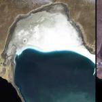
Example:
Cost and payment
The cost of linking one county is from 400 to 1500 rubles (depending on the complexity, number of sheets and the need for gluing them together). Payment is possible in electronic currencies, through express payment terminals or in any other convenient way as agreed upon.
Several years ago, almost simultaneously with the 3 layouts, even older PGM maps became available. General survey plans were mostly drawn up before 1800 and have a layout scale.
The usefulness of such a map in searching with a metal detector is 100% obvious, but... I rarely open them, although there are all the places where I dig. The first disappointment came when I couldn’t tie them. Secondly, what can I see on them that is not on the 3rd layout? There is no fair where the tables were (which is a pity).
It seems that there are old maps of high detail, on which even individual houses are indicated (in some places, barns, cool!)... But it is very difficult to get real practical use from them. Okay, it’s impossible to pin down exactly by coordinates, but flaws appear even in small things.
On the PGM map there are 3 houses in the village, at the digging point there are 5 of them. According to the map they are in a row, in reality there are 50 meters of “chess” between them. And any discrepancy between such cards (and their summation) turns out to be wasted time.
Story 1
We found a farmstead on the PGM, which was not on the three-layout map... Moreover, I know that the layouts have a very large error, and you shouldn’t rely on the coordinates. “I became attached” to the hills, which seemed to remain in place and were visible on the General Staff.
We arrived, wandered around for 3 hours, trying to locate the house... Moreover, they weren’t looking for bricks, then such houses were made of wood - they were looking for clay shards, “calling up” horse meat, or generally anything from that time. Result 0.
There were several such attempts, and not only me.
Story 2
We gathered for the plowed village. Based on the layout, they estimated the central estate, which was also called a stone house (at that time this was a big deal). 2 hours passed... As a result, the finds actually appeared only when we moved 200 meters from the initially planned point.
If we had arrived and immediately embarked on a broad reconnaissance (instead of marking time in the “exact” place), we would have localized it much faster.
Bottom line
So it turned out that my main cards are . Accuracy is passable, detail is average. The most important thing is that I don’t waste so much time with them when localizing on site.
I specifically asked my comrades if anyone had real example How did the PGM map lead to the cop's point? Moreover, such that the PGM is the only source of information, and without it these finds would not have happened. So far we don’t have such an example, although most have PGM cards))
P.S. Please note ➨ ➨ ➨ Bomb theme - . Take a look, you won't regret it.