Going on an interesting journey or simply looking at maps on the Internet, each person is faced with such a concept as scale. However, not everyone knows what it is, what types of scales are and how to calculate it correctly.
What is scale
The word "scale" came into Russian from the language of accuracy - German - and literally translates as a stick for measuring. However, in cartography, this term refers to the number of times a given map or other image is reduced in comparison with the original. The scale is present on every map, and is also an integral part of any drawing.
What is the scale for?
So why do people need scale in practice? What does scale show? In fact, this concept is connected practically and theoretically with many branches: mathematics, architecture, modeling and, of course, cartography. After all, it is impossible to display a geographical object in its real size on any map, even an ultra-modern digital one. Therefore, when drawing the image of certain cities, rivers, mountains, or even entire continents on a map, all these objects are proportionally reduced. And how many times this is done, and is the scale, which is indicated on the margins of the map. 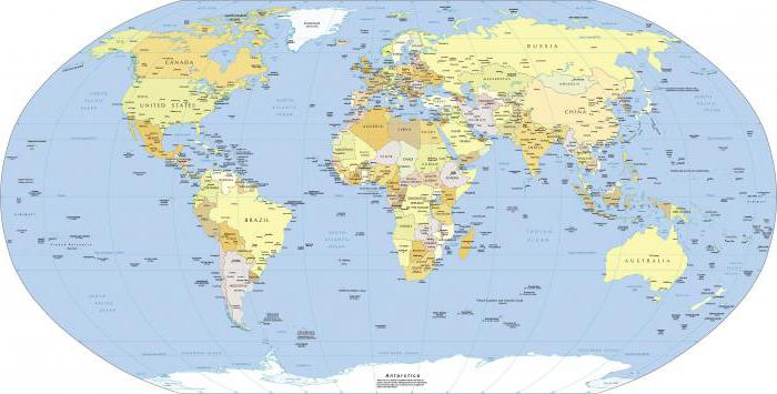
In the old days, when cartography did not yet use a scale, but reduced the depicted objects at its discretion, the resulting maps were very inaccurate and were rather approximate. So travelers using them often got into a mess. Who knows, perhaps the map used by Christopher Columbus also had the wrong scale, and therefore, instead of India, he sailed to America?
Another industry that simply cannot exist without the use of scale is modeling. Indeed, when creating a drawing of a future building or aircraft, an engineer does it on a certain scale, reducing or enlarging the image, depending on the need. So not a single, even the smallest detail, can be made without the use of a drawing, and no drawing can do without a scale.
Main types of scales
Despite the simplicity of the concept of "scale", there are several types of it. On maps, it is usually indicated either with numbers (numerical) or graphically. Graphic scales are divided into two subspecies: linear scale and transverse. 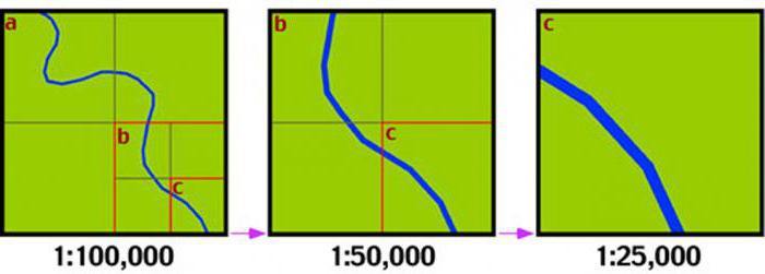
There are also scale subspecies, which are more related to map types. Depending on the size of the scales, maps are distinguished:
- Large-scale - from one to two hundred thousand or less.
- Medium-scale - from one to a million to one to two hundred thousand.
- Small scale - up to one in a million.
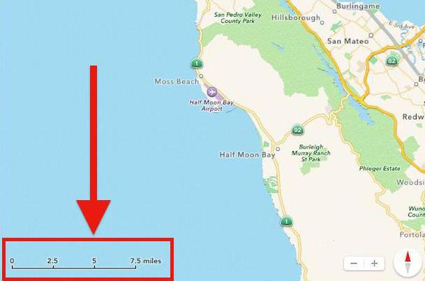
Naturally, on small-scale maps, some details are not applied, while at the same time, large-scale maps may contain the names of streets and even small lanes. In modern electronic maps, the user can adjust the scale himself, turning the map from small-scale to large-scale in an instant, and vice versa.
Numerical and named scale
Scale data can be specified in a variety of ways. If on a map or drawing the scale is indicated using a fraction (1:200, 1:20,000, etc.), then this type of scale is called numerical. When calculating this size, it is worth taking into account the fact that the scale with the smaller number in the denominator will be larger. In other words, objects on a map with a scale of 1:200 will be larger than on a map with a scale of 1:20,000.
The named scale specifies not just the size of the image reduction, but also names the units of measurement with which this is done. For example, on the map of the area it is indicated that 1 centimeter on it is equal to 1 meter. The named scale is rarely used for small-scale maps, and indeed for maps in general. It is more practical for various drawings. Especially if it is a tiny detail or, on the contrary, a huge residential complex.
Graphic Scale
Graphic views of scales, as already mentioned above, come in two variants.
Linear is a scale depicted as a uniformly divided two-color ruler. As a rule, it is used on large-scale terrain plans and makes it possible to measure the distance on it using a paper strip or compass. This graphical scale option can help you determine the length of rivers, roads, and other curved lines.
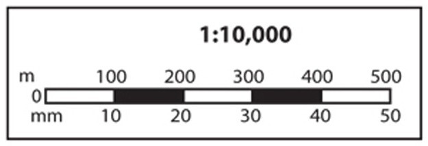
Transverse is an improved version of the linear scale. Its purpose is to determine the distance indicated on the plan as accurately as possible. A similar graphical option is usually used on specialized maps.
Drawing scales
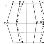
Having considered the most common types of scales in cartography, it is worth mentioning that this concept is also inextricably linked with drafting and architectural graphics. Whether they are engineering drawings of tiny mechanical parts or, on the contrary, drawings of huge architectural ensembles, in any case, specialized drawing scales are applied to them. Each drawing form has a column in which the scale of the designed product is indicated without fail.
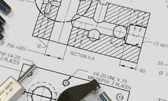
It is noteworthy that even if the engineer creates a full-size drawing of the part, the scale of 1: 1 is still indicated in the information about it. Unlike maps, in the drawings the scale can be not only reduced (1:5), but also enlarged (5:1) if the depicted product is tiny in size.
To date, only narrow specialists need the ability to correctly calculate the scale without the help of machines. Thanks to modern programs and devices, other people no longer need to be well versed in the scale of a particular map - the computer will do everything for them. But still, everyone should have at least an approximate idea of \u200b\u200bwhat the scale shows, how to calculate it correctly and what types of it exist - after all, this is a component of elementary literacy and human culture.